Halfway up the Hieroglyphic Stairway at Copán, you stop reading the carvings. Not because there’s nothing to read; the opposite. Sixty-four steps, 2,200 individual glyphs, the longest known Maya inscription anywhere. It’s the dynastic record of a single city told in stone, and the moment you realise you’re looking at the obituary of K’ahk’ Uti’ Witz’ K’awiil, the thirteenth ruler of Copán, the carvings stop being decoration and start feeling like a person actually died here. He did, in 695 CE. The men who built that stairway weren’t trying to impress tourists. They were trying to keep one specific king alive in collective memory for a thousand years. They got further than they had any right to expect.
That’s the strange thing about Mayan ruins in Central America. They’re presented to you as archaeology, as ancient pyramids in jungle clearings, as photogenic stops on a Guatemala loop. They are all of those things. But every one of these sites is also a record of someone’s life, written by people who genuinely believed that if they cut their stelae deep enough and stacked their pyramids high enough, they could outlast time. So far, they’re winning.
This is the practical comparison guide for anyone planning to actually visit some of these places. I’ll tell you what I think is worth your time, what to skip if you’re tight, how the headline sites compare to each other, and what the smaller ones do that Tikal can’t. The seven Central American countries together hold something like forty serious Maya sites; this guide focuses on the dozen you’re realistically going to consider, plus brief notes on the few elsewhere that you’ll hear about and want context on.
In This Article
- A two-paragraph history before the comparison guide
- Tikal, Guatemala: the headline site, no contest
- Yaxhá, Guatemala: Tikal without the buses
- El Mirador, Guatemala: the one for adventure types
- Quiriguá, Guatemala: small site, biggest stelae anywhere
- Copán, Honduras: the carving capital
- Caracol, Belize: the size of Belize City, hidden in a forest
- Lamanai, Belize: the boat-ride site
- Xunantunich, Belize: the easy day trip
- Cahal Pech, Belize: the one inside town
- Altun Ha, Belize: the Belikin beer site
- Joya de Cerén, El Salvador: the Pompeii of the Americas
- Tazumal, El Salvador: the largest in the country
- How they actually compare
- What about Chichén Itzá and Palenque?
- Practical notes that apply to all of them
- Sources and further reading
A two-paragraph history before the comparison guide
The Maya didn’t disappear. That’s the first thing to know. Around seven million Maya people live across Guatemala, southern Mexico, Belize, El Salvador and the western fringe of Honduras, speaking around thirty Mayan languages, weaving the same patterns their ancestors did, attending the same Sunday markets at the same towns. K’iche’, Kaqchikel, Yucatec, Q’eqchi’, these aren’t ancient languages, they’re current ones. Walk into the market in Sololá above Lake Atitlán on a Friday and you’re seeing modern Maya people doing modern Maya things. The ruins are the part of the civilisation that stopped; the people are the part that didn’t.
The civilisation runs in three rough chunks. The Preclassic (roughly 2000 BCE to 250 CE) is when the first big cities went up, Nakbé, El Mirador, Cahal Pech. The Classic (250-900 CE) is the headline period: Tikal at its peak, Copán’s dynasties, Caracol’s wars, hieroglyphic literacy at its highest density anywhere in the pre-Columbian Americas. Then around 800-900 CE the southern lowlands collapsed. Cities were abandoned, dynasties stopped commissioning monuments, populations crashed. Nobody knows precisely why; drought, war, soil exhaustion, internal politics, all four together, the leading theories all sound plausible and none of them is settled. The Postclassic (900-1521 CE) is the rebuild in the north, Chichén Itzá, Mayapán, Lamanai still going, the Yucatán flowering again, until the Spanish arrived and the conquest of the highlands began in 1524. That’s it. The ruins you’ll visit are mostly Classic-period cities that didn’t survive the 9th-century collapse, plus Postclassic ones that did.
Tikal, Guatemala: the headline site, no contest
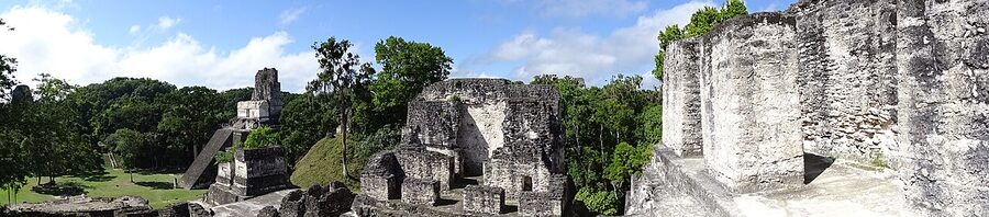
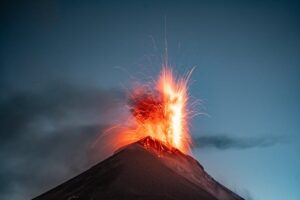
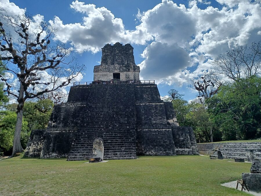
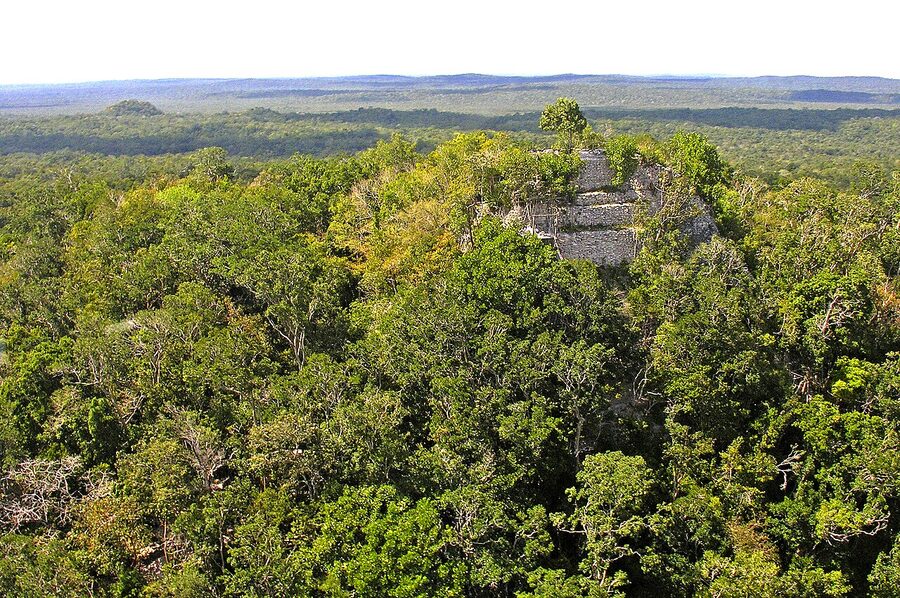
If you only see one Mayan site in Central America, it’s Tikal. Not because it’s the most beautiful (Copán beats it on that), or the most peaceful (Yaxhá wins there), but because Tikal is the one that gives you the full sense of scale. The site covers more than 16 square kilometres of excavated and partially-excavated ruins, with around 3,000 documented structures and an estimated 10,000 more still buried in the surrounding jungle. At its 8th-century peak the population sat around 90,000 people; this was a serious city. Today you can climb Temple IV, the tallest at roughly 70 metres, and look out over a green ocean broken only by the tops of three or four other pyramids. That view is the one Star Wars used as the rebel base in A New Hope, and it’s still genuinely jolting in person.
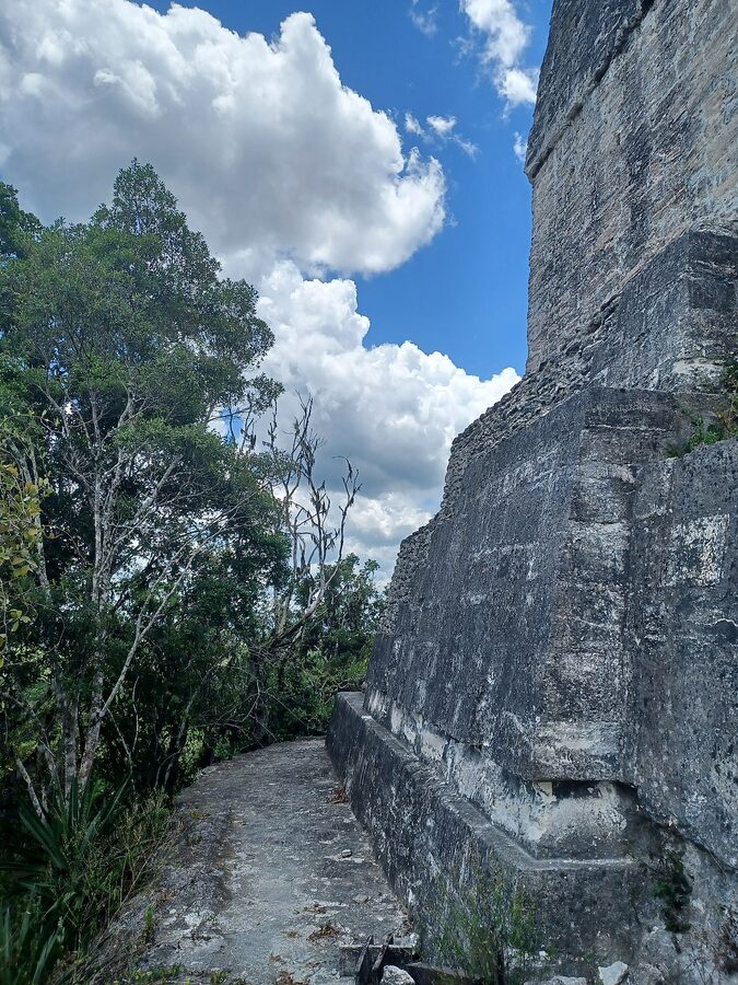
Logistics. Tikal is a UNESCO World Heritage Site (inscribed 1979) inside Tikal National Park, about an hour’s drive from Flores. Most travellers fly into Flores from Guatemala City on the morning TAG or Avianca flight, do Tikal as a sunrise or full-day tour, and fly back the same evening. Park entry is currently 150 quetzales for foreigners (around Q150 = about 7-8 to the USD). Sunrise tours add a separate Q100 surcharge and require booking via licensed guides. What I’d actually skip: the sunrise experience is overrated unless you specifically want the howler-monkey soundscape from the top of Temple IV. The view itself is better in soft mid-morning light when the haze lifts. A regular 9am-3pm visit covers the major plazas comfortably and you’ll see more wildlife, coatis, oscillated turkeys, occasionally a tapir near the campsite.
Where to base. Flores is the obvious choice, colourful, walkable island town on Lake Petén Itzá, plenty of cheap rooms and decent restaurants. The Tikal campsite inside the park exists if you want to be on-site for a self-organised sunrise (no booking, first-come), but most people prefer Flores. If you’re routing this with Antigua + Lake Atitlán, the typical sequence is Antigua → Lake Atitlán → fly to Flores from Guatemala City → Tikal. You can also do Tikal as part of an overland route from Belize via the Melchor de Mencos border.
Yaxhá, Guatemala: Tikal without the buses
Yaxhá is what Tikal would be if Tikal weren’t the famous one. About 30km southeast of Tikal, on the northern shore of Laguna Yaxhá, this is the third-largest Classic Maya city in Guatemala behind Tikal and El Mirador. Roughly 500 structures excavated, around 3,000 estimated total. The temples are smaller than Tikal’s biggest, but you can climb most of them, and from Templo 216 you get a sunset view across the lagoon that beats anything Tikal offers, pink water, a half-disc of red sun, howler monkey roar starting up in the canopy below. I saw more wildlife in three hours at Yaxhá than in a full day at Tikal: spider monkeys, two coati troops, a pair of toucans, and exactly four other tourists.
Logistics. Q80 entry, no separate sunset surcharge. Best done as a half-day tour from Flores, your driver leaves around 1pm, you arrive 3pm, climb to Templo 216 by 5:30, watch sunset, drive back. Tour operators in Flores run shared vans for around Q200-300 per person. A few sunrise tours exist but the road in is rough and most operators don’t bother. If you have two days in Petén, do Tikal Day 1 and Yaxhá Day 2. If you only have one, do Tikal, but if you have any choice at all, find time for Yaxhá. It’s the one site where I felt like a real person walking through a real city.
El Mirador, Guatemala: the one for adventure types
El Mirador is the truly remote one. Deep in the Maya Biosphere Reserve near the Mexican border, accessible only by a multi-day jungle trek (typically five or six days round trip from Carmelita village) or by helicopter charter from Flores. The site contains the largest pyramid the Maya ever built, La Danta, rising 72 metres above the jungle floor and over 230 metres long at its base. By volume of construction material, La Danta is one of the largest pyramids in the world; only the Great Pyramid of Cholula in Mexico exceeds it. The site dates from the late Preclassic period, peaking around 300 BCE to 150 CE, which makes it older than Tikal’s golden age.
Logistics. The trek runs around US$300-450 per person through licensed cooperatives, all-inclusive of guides, mules, food and camping gear. You walk roughly 60km each way through dense rainforest with no infrastructure and a serious chance of seeing jaguar tracks. Helicopter day trips run around US$700-1,000 depending on the operator and how many seats fill. Should you do it: if you’ve already trekked Acatenango and want another physical challenge with a deeper-cut payoff, El Mirador is exceptional. If your idea of a hike is a hot afternoon at Tikal, this trip will hand you back your spine in a sealed envelope. Wet-season treks (June to October) are hard work; January to April is the right window.
Quiriguá, Guatemala: small site, biggest stelae anywhere
Quiriguá doesn’t get the headlines. Eastern Guatemala, on the road between Guatemala City and the Caribbean coast at Río Dulce. UNESCO inscribed it in 1981. The whole archaeological zone is small, you can walk it end to end in 90 minutes, and the buildings are modest by Tikal standards. So why is it on this list? Because of the stelae. Quiriguá’s carved stone monuments are the tallest in the entire Maya world. Stela E stands over 10 metres tall above ground level and is cut from a single piece of sandstone weighing more than 60 tonnes. The carving is some of the most refined in Maya art, and the monuments record one of the great political reversals of Classic Maya history: the day in 738 CE when Quiriguá’s underdog ruler K’ak’ Tiliw Chan Yopaat captured and beheaded his much more powerful overlord, Copán’s 18 Rabbit (Uaxaclajuun Ub’aah K’awiil). One battle, one execution, one site flipping from vassal to capital. The stelae celebrating this victory are still there.
Logistics. Q80 entry. Easy stop on a Guatemala City to Río Dulce drive, exit Highway CA-9 at the Quiriguá turnoff, drive 4km in, two hours on site, drive on. If you’re heading from Antigua to Copán Ruinas via the El Florido border, you can fold Quiriguá in as a half-day detour. Pair it with Copán, visiting the two together turns the 738 CE story from a footnote into a road trip.
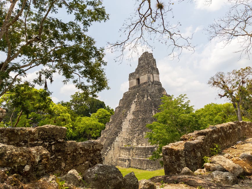
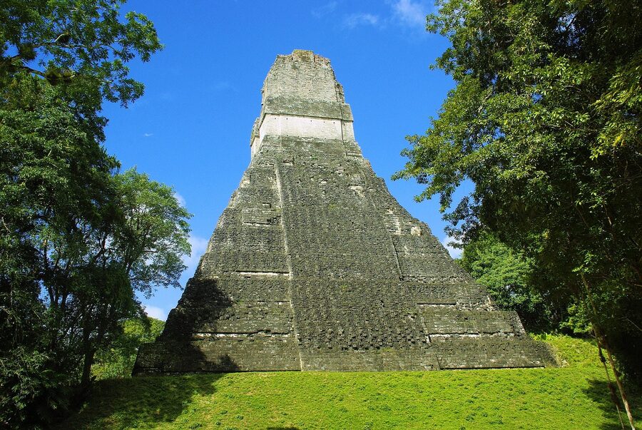
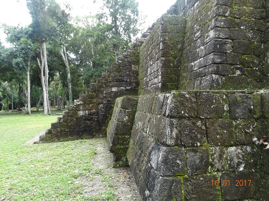
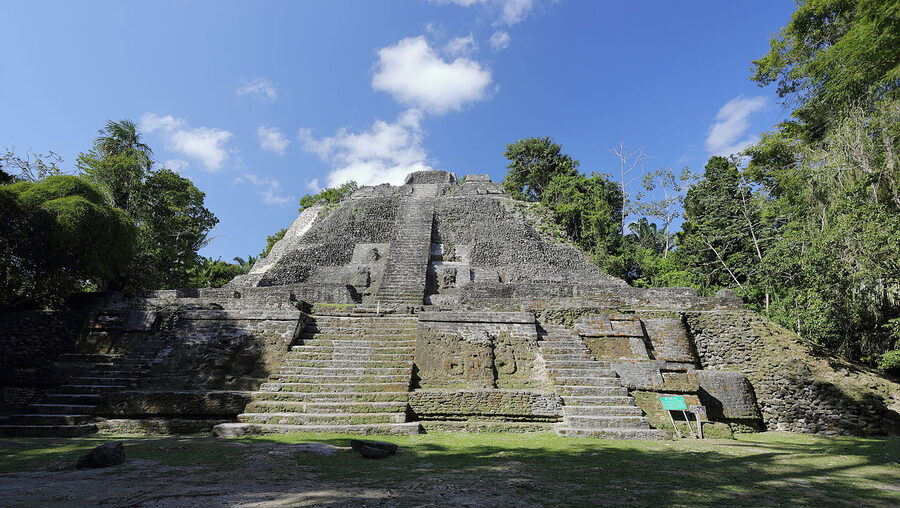
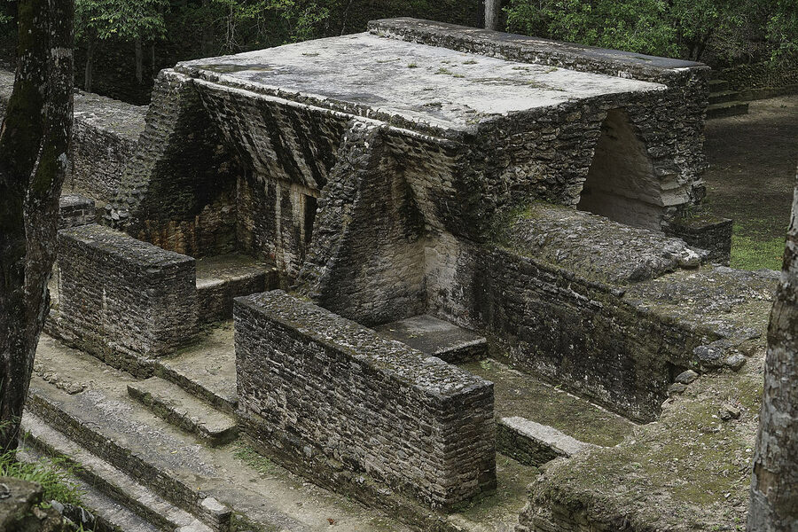
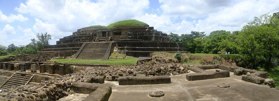
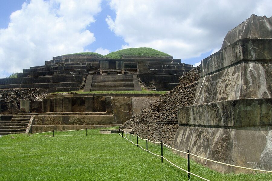
Copán, Honduras: the carving capital
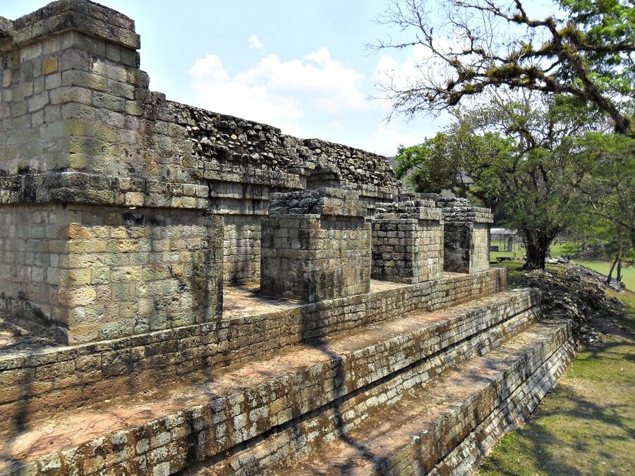
Tikal wins for grandeur. Copán wins for everything else. The site sits in a green river valley in western Honduras, just across the Guatemalan border at El Florido, and it’s been a UNESCO World Heritage Site since 1980. Where Tikal is about scale, Copán is about detail. The site is famous for two specific features that you won’t find anywhere else.
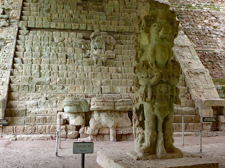
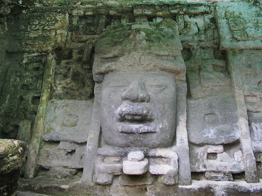
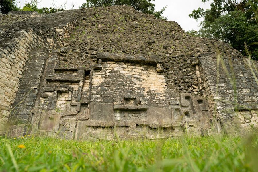
The first is the Hieroglyphic Stairway, that 64-step, 2,200-glyph staircase I opened with. It records the dynastic history of Copán’s rulers in a single architectural object. Scholars are still translating sections of it. Most of the original stones were rearranged out of order during a 1930s reconstruction, which means we have all the words but the sentences are scrambled, like a torn-up letter someone glued back together with no copy of the original. Decoding it is one of the long-running puzzles of Mesoamerican archaeology.
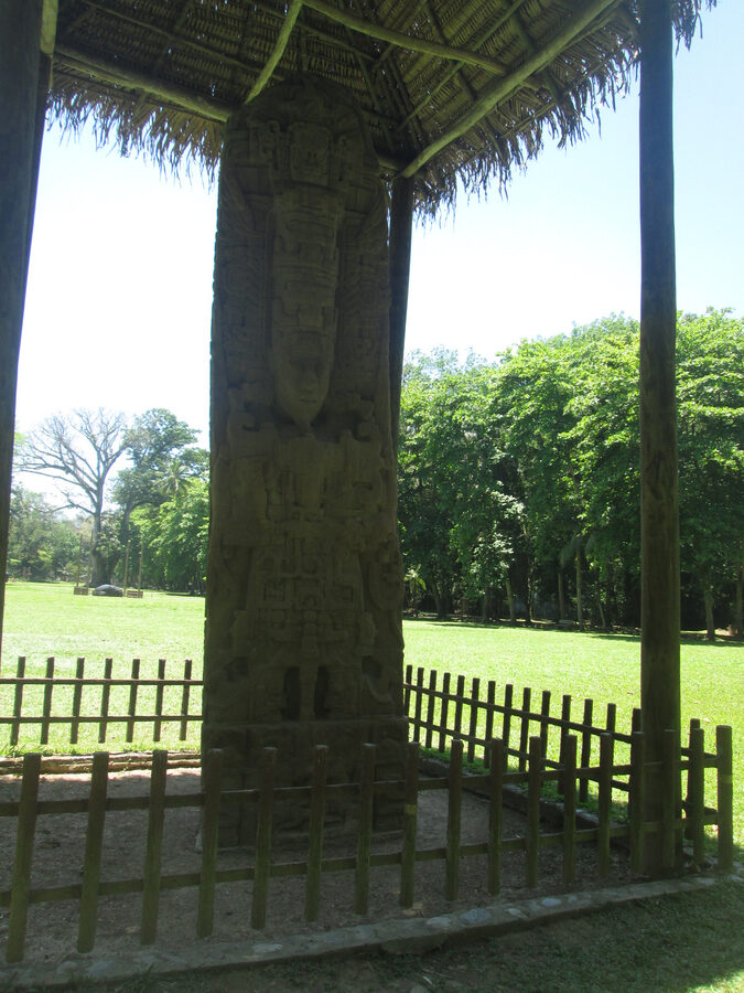
The second is the stelae of the Great Plaza. Copán’s rulers had a particular obsession with high-relief portraiture, and the result is around twenty stone monuments depicting kings in such deep three-dimensional carving that they look more like sculptures than slabs. Stela H, depicting 18 Rabbit (the same king Quiriguá later beheaded) in full ceremonial dress, is one of the masterworks of pre-Columbian American art, full stop.
Logistics. Park entry is L420 (around 25 lempiras to the USD). Add L150-300 for the museum, which is genuinely worth it, the original stelae moved indoors are inside, replacements stand in the field. The town of Copán Ruinas (population around 9,000) sits a 15-minute walk from the site entrance and is one of the more pleasant base towns in Honduras, with cobblestone streets and a working-traveller atmosphere. How to get there: Hedman Alas runs a daily premium bus from Antigua Guatemala via the El Florido border, around US$45 each way and the easiest cross-border ride in the region. From San Pedro Sula or Tegucigalpa it’s a longer haul but doable. Why pick this one: if you only had two days in Central America and had to pick one site, I’d take Copán over Tikal. The carving is closer, more legible, more human. Tikal is the bigger experience; Copán is the better one.
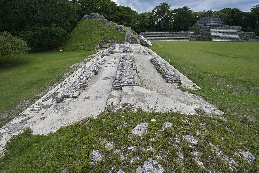
Caracol, Belize: the size of Belize City, hidden in a forest
At its 7th-century peak, Caracol housed around 100,000-150,000 people across an area of roughly 200 square kilometres, three times the modern population of Belize City. Today it’s effectively empty. The site sits inside the Chiquibul Forest Reserve, a two-hour drive south of San Ignacio along an unpaved jungle track that’s only fully passable in dry season (December-May). The remoteness is the point. Caana, the Sky Palace pyramid, is still the tallest structure in modern Belize at 43 metres, and you can climb it. From the top you see uninterrupted forest in every direction. No roads, no rooftops. The place was named for the snail shells colonial explorers found scattered across it, caracol means “snail” in Spanish.
Logistics. BZ$15 entry (Belize dollar, pegged 2:1 to USD, both accepted). The drive from San Ignacio runs three hours each way; nobody does this site as a self-drive without a 4×4 with high clearance. Day tours from San Ignacio run BZ$200-300 per person, usually combined with a swim stop at the Río On Pools or a side trip to Rio Frio Cave. Where to base: San Ignacio in the Cayo District. It’s also the base for Belmopán-area day trips and the Mountain Pine Ridge Reserve. Worth the day: Caracol is a long day for a remarkable site, but the journey itself is half the experience. If you’d rather not invest a full 12-hour day, Xunantunich gives you a more compact Belize ruin without the back roads.
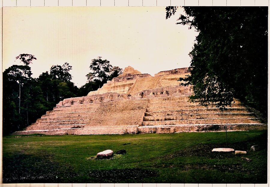
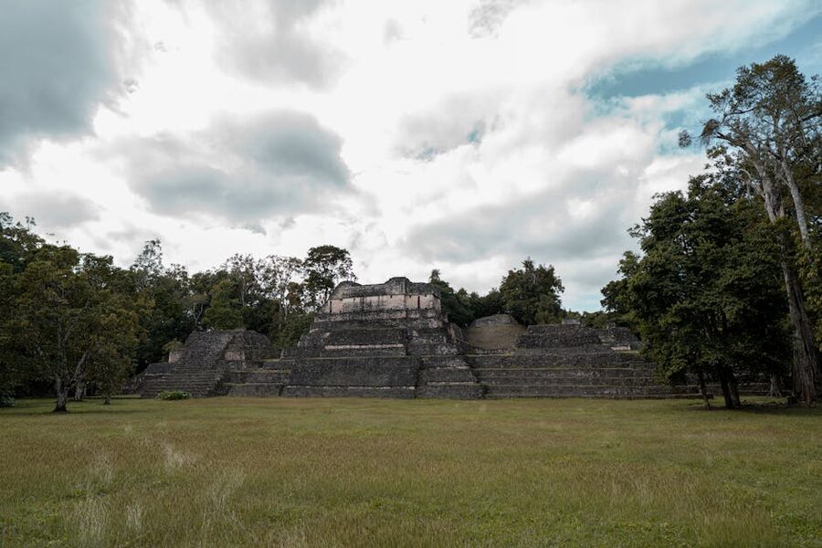
Lamanai, Belize: the boat-ride site
Lamanai means “submerged crocodile” in Yucatec Maya, which is what gave the place its name in roughly 100 BCE and what the carved masks on the Mask Temple still depict. The site sits on the New River Lagoon in northern Belize, and the access route, a 45-minute speedboat ride upriver from Orange Walk through palm-lined banks lined with crocodiles, iguanas, ospreys and more morpho butterflies than you’ll see in your life, is genuinely the best journey to any ruin in Central America. Lamanai was occupied continuously for around 3,000 years, longer than almost any other Maya city. It was still functioning when Spanish missionaries arrived in the 16th century. The ruined Spanish church inside the archaeological zone is part of the site.
Logistics. BZ$10 entry, but you’ll usually pay it bundled into a day-tour price of BZ$120-180 from Orange Walk including the boat ride and lunch. Tours leave Orange Walk around 8:30am, return 4:30pm. Some operators run from Belize City for an extra hour each way and a higher price; not worth it if you can get to Orange Walk yourself. The verdict: Lamanai’s three big temples, Mask, High, and Jaguar, are smaller than Caracol’s Caana or Tikal’s Temple IV, but the boat journey is what sells this site. If your group has a kid who’d be bored on a steep climb, the river ride keeps everyone engaged.
Xunantunich, Belize: the easy day trip
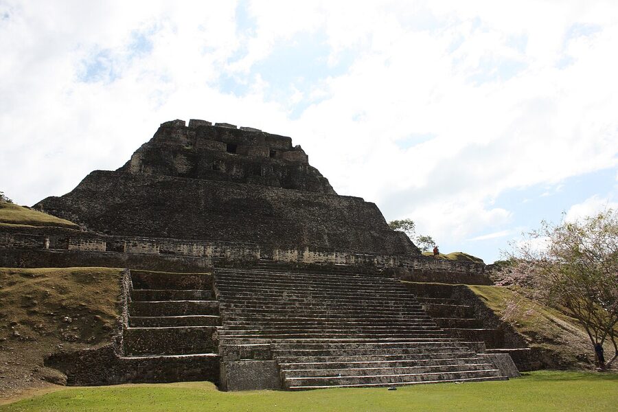
Xunantunich is the Belize ruin you visit if you want a real Maya site without committing a full day. The name means “Stone Woman” in Mopan Mayan, after a folk legend about a ghostly white-clad figure villagers said haunted El Castillo, the central pyramid. From the top of El Castillo (a climb of around 130 steep stone steps) you can see across into Guatemala; the border is less than 2km away. The site is small enough to cover in two hours and impressive enough to justify the trip.
Logistics. BZ$10 entry. Easy half-day trip from San Ignacio, 13km west on the Western Highway. You take the hand-cranked cable ferry across the Mopan River (free, runs roughly 8am-5pm), drive the last kilometre uphill, and you’re there. Local taxis from San Ignacio charge BZ$60-80 round trip including waiting time; tour operators bundle it for BZ$90-120 with a guide. Why this one: if you’re already in Belize and short on time, Xunantunich is the obvious pick over Caracol. The El Castillo summit view across two countries is one of those quiet moments that beats any monument photograph.
Cahal Pech, Belize: the one inside town
Cahal Pech sits on a hill on the western edge of San Ignacio, walking distance from the town’s main square. The name means “Place of Ticks” in Yucatec Maya, the surrounding pasture was infested when archaeologists rediscovered it in the 1950s. The site is small (around 40 buildings around seven plazas) but exceptional for one reason: it was occupied from roughly 1200 BCE to 800 CE, around 2,000 years, which makes it one of the longest continuously-inhabited Maya settlements anywhere. The earliest carved stela in Belize, Stela 9, was found here. The site museum has good interpretive panels for what the site looked like in its painted-stucco prime.
Logistics. BZ$10 entry. Walk from San Ignacio centre, 15 minutes uphill. Open daily 6:30am-4:30pm. The verdict: Cahal Pech is a great filler if you have a half-morning before a Caracol or Xunantunich tour, or as a Sunday-morning trip when other tours aren’t running. On its own merits it’s not a destination, pair it with something else.
Altun Ha, Belize: the Belikin beer site
Altun Ha is the easiest Maya site to reach in Belize, around 50km north of Belize City and a popular day trip from the Caribbean coast and the cayes. The Temple of the Masonry Altars, the site’s main pyramid, is also the most reproduced image in Belize: it appears on the bottle of Belikin, the country’s national beer. The site itself is more compact than Lamanai or Caracol, around 13 main structures around two plazas, and was a key trade hub during the Classic period thanks to its access to the Caribbean coast just 6km east.
Logistics. BZ$10 entry. Day tours from Belize City run BZ$80-120, often combined with a stop at the Belize Zoo or Crooked Tree wildlife sanctuary. From Caye Caulker or Ambergris Caye you can do it as a day return via the morning water taxi. The verdict: Altun Ha is the right pick if you’re cruise-passenger-style time-limited or based on the cayes and want a half-day cultural break from snorkelling. If you’re already in Cayo District and committing more time, skip Altun Ha for Xunantunich or Caracol.
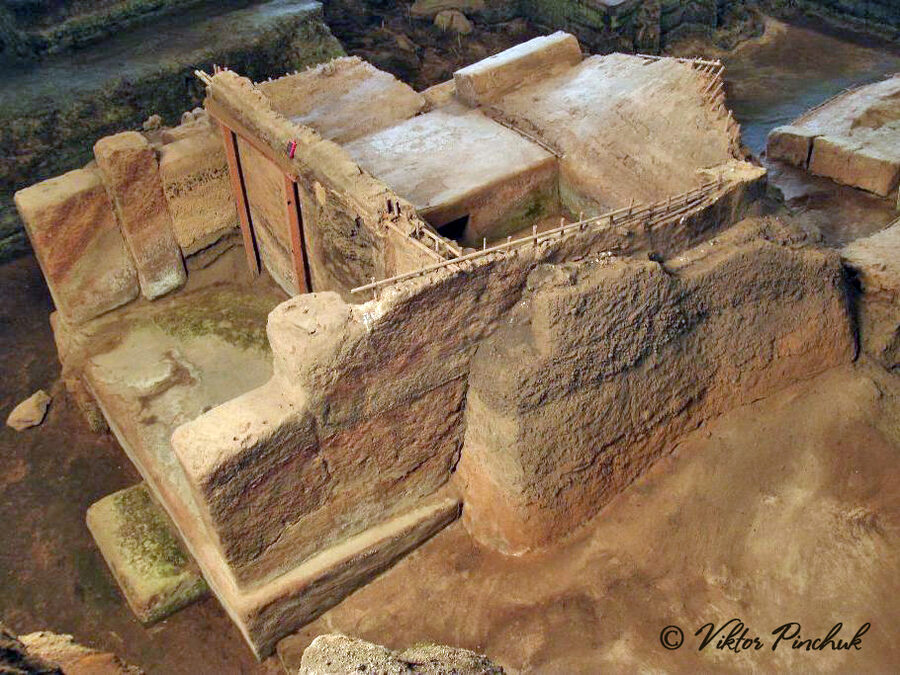
Joya de Cerén, El Salvador: the Pompeii of the Americas
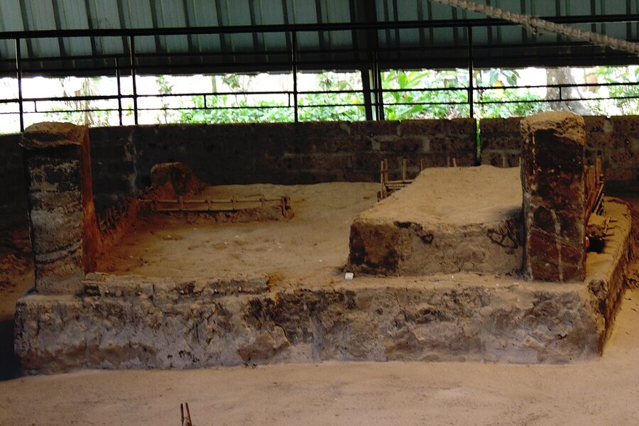
Joya de Cerén is unlike any other site on this list. There are no pyramids. There are no plazas, no royal tombs, no carved stelae. What you see is a farming village. Kitchens, sleeping quarters, sweat baths (temazcales), maize fields with the rows still visible. All of it preserved under five metres of volcanic ash from the eruption of the nearby Loma Caldera around 600 CE. The villagers fled in time, leaving everything behind: half-eaten meals on the table, ceramic pots full of beans, woven mats still on the floor. The ash entombed it all. UNESCO inscribed Joya de Cerén in 1993 and the comparison to Pompeii is constant for good reason. It’s the only place anywhere in the Maya world where you can see how ordinary people, not kings, actually lived.
Logistics. US$3 entry (El Salvador uses the US dollar). The site is in San Juan Opico, around 35km northwest of San Salvador. Day tours from the capital run US$30-50; you can also self-drive in 45 minutes. Plan around 90 minutes on site (it’s small). The verdict: Joya de Cerén is a strange site to visit because there’s nothing visually impressive in the way the big pyramids are impressive. It’s a row of low walls under shelter roofs. But standing where someone left a bowl of maize half-eaten 1,400 years ago does something to you that no royal monument quite manages. Pair it with Tazumal for a full day of Salvadoran archaeology.
Tazumal, El Salvador: the largest in the country
Tazumal is the largest Maya archaeological zone in El Salvador, located in the town of Chalchuapa about 80km west of San Salvador. The name means “place where victims were burned” in K’iche’. The main pyramid (Structure B1-1) is around 24 metres tall, and although the site is small by Tikal or Caracol standards, it has been continuously occupied for an extraordinary span, from around 5000 BCE up to roughly 1200 CE, with peaks during the Classic period (around 250-900 CE) and later under Pipil influence in the Postclassic. The site museum holds the original of one of the most important monuments found here: a hieroglyph-carved basalt stela now displayed at the Museo Nacional de Antropología in San Salvador. Skeletons unearthed here have raised long-standing questions about Maya sacrificial practices.
Logistics. US$3 entry. Easy day trip from San Salvador, around 90 minutes by car or chicken bus via Santa Ana. Pair with Joya de Cerén on the same out-and-back loop. The verdict: Tazumal isn’t a destination on its own merits. The cement reconstruction work damaged the visual integrity, and the site is much smaller than the headline ruins elsewhere. But if you’re already in El Salvador, it’s worth half a day for the museum and the raw fact that you’re walking on layered occupation that goes back 7,000 years.
How they actually compare
Here’s the calibration in plain English. Tikal is the biggest, the most famous, and the one most travel itineraries build around. Copán is the most artistically refined, with carving you won’t find elsewhere, and it’s a cleaner cross-border trip from Antigua Guatemala than people expect, thanks to Hedman Alas. Yaxhá beats Tikal for atmosphere and wildlife, hands down, but you have to be willing to skip the famous one to enjoy it. Caracol is the connoisseur’s pick, gigantic, isolated, the only way to see what an empty Maya city actually feels like. Lamanai wins for the journey rather than the destination. Xunantunich is the easy day-trip option in Belize. Cahal Pech and Altun Ha are both filler-class, useful additions, not standalone trips. Joya de Cerén is the most intellectually rewarding site on the list, even though it’s the least visually striking. Tazumal is for completists. Quiriguá is a fold-in stop on a longer route. El Mirador is for travellers who’d otherwise be planning a multi-day trek somewhere harder to get to.
If you’re staring at a two-week Central America itinerary right now, the best Maya pairing is Tikal + Copán. Fly into Guatemala City, do a few days in Antigua, take Hedman Alas to Copán Ruinas (about 6 hours, comfortable), bus or fly back to Guatemala City, fly to Flores for Tikal, return. That’s two of the three most important Mesoamerican archaeological sites in one trip, plus colonial Antigua, plus enough time in Lake Atitlán for it not to feel rushed. If you have an extra three or four days, add Yaxhá from Flores. If you have two weeks specifically for ruins, add Quiriguá on the road from Guatemala City to Río Dulce, and tag on Joya de Cerén from a cross-border bounce into El Salvador.
What about Chichén Itzá and Palenque?
Two famous Maya sites sit in Mexico, not Central America, and you’ll hear constant mentions of both, so it helps to know what they actually are. Chichén Itzá, in the Yucatán Peninsula, is the late-period (Postclassic) Maya capital that became one of the New Seven Wonders of the World in 2007. The Pyramid of Kukulcán (El Castillo) is the most photographed Maya structure on earth. It’s a different category of site, rebuilt for tourists, fenced off so you can’t climb anything anymore, packed with cruise-day-trippers from Cancún. Visually striking; experientially controlled. Palenque, in Chiapas, is the Classic-period jungle equivalent, smaller than Tikal but with finer carving and a more compact layout. Many travellers who do both rate Palenque higher than Chichén Itzá for atmosphere.
Neither is in Central America. Both are reachable from the southern Mexico/Guatemala border on a longer overland route, but they’re not part of the trip you’re planning if you’re flying into Guatemala City or San Salvador. Mention this guide pairs more naturally with the regional alternatives, Tikal stands in for Chichén Itzá’s grandeur, Yaxhá and Copán cover the carved-stela end, Joya de Cerén does the daily-life-preservation thing that no Mexican site can match.
Practical notes that apply to all of them
Time of year. Dry season in the Maya region runs roughly mid-November through April. This is when access roads to remote sites (Caracol, El Mirador, even parts of Yaxhá) are passable. Wet season (June through October) brings spectacular green and dramatic clouds, plus ankle-deep mud and surprise downpours. The shoulder months, November and May, are the best balance.
Sun and shoes. Most of these sites have minimal shade once you leave the main plazas. Bring a hat. Stone steps are uneven, often slick after rain, and frequently steeper than they look, running shoes or trail shoes, never sandals. Climb backwards down the steepest temples (Caana, Temple IV at Tikal, El Castillo at Xunantunich); locals do it that way for a reason.
Guides. A licensed guide for two hours at a major site adds something a guidebook cannot, the dynastic stories, the directional alignments, which carving is original and which is reconstruction. Pricing varies but US$25-50 for a private 2-hour walk-through is the standard. At Tikal and Copán the on-site guides are typically excellent. At Joya de Cerén a guide is essential because so much of the site’s significance is invisible without explanation.
Cash. Park entry at most sites is cash-only in local currency. Quetzales for Guatemala (Q150-300 typical), lempiras for Honduras (L420 at Copán), Belize dollars or USD for Belize (BZ$10-15), and US dollars for El Salvador (US$3 each). ATMs in the small base towns work but go down occasionally; carry enough cash from the nearest city.
Respect the carvings. Don’t touch the stelae. Don’t stand on top of altars. Don’t carry off “loose” stones from the site (they’re not loose; they’re catalogued). The Maya descendants of these sites are still around, still using them, still consulting them in ceremony. The least we owe them is leaving the place intact.
Sources and further reading
This guide draws on UNESCO World Heritage documentation for the listed sites: Tikal National Park, Maya Site of Copán, Archaeological Park and Ruins of Quiriguá, and Joya de Cerén Archaeological Site. Also useful is the Guatemalan IDAEH (Instituto de Antropología e Historia) for ongoing excavation reports and current site access conditions.
For more things to do across the region, see the related country guides, Guatemala, Belize, Honduras, and El Salvador, which cover routing, transport, and when each country is at its best.