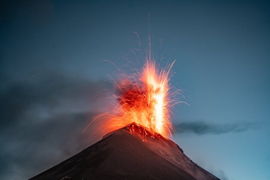
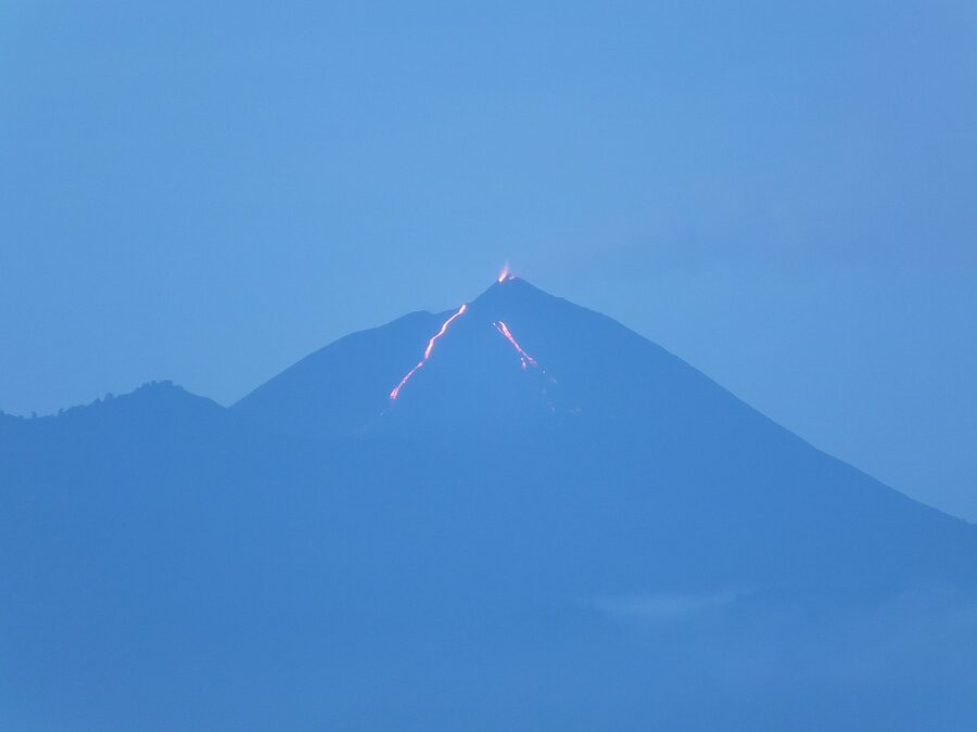
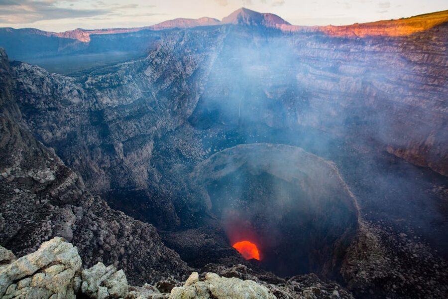
Just before midnight on the rim of Acatenango, with the wind cutting straight through three layers of fleece, Fuego goes off again. A red glow the size of a soccer field opens up inside the cone three kilometres south, then the shockwave reaches you a second later, low in the chest like a subwoofer. Nobody talks. The Israeli kid next to me drops his head torch in the ash. This is the moment the entire grueling slog up was for, and you understand it instantly: every gram of camera gear, every step on that 45-degree pitch through scoria, every hour of altitude headache. Fuego erupts roughly every fifteen minutes through the night. You stop counting after three.
Central America runs on a chain of around fifty active and recently-active volcanoes from Guatemala to Panama, and most of the famous ones are climbable in some form. Some are five-hour day hikes you can do hungover from a hostel in Granada, Nicaragua. Some are two-day expeditions with sub-zero summits, mandatory guides, and altitude sickness as a real risk. One of them ends with you sandboarding down a 700m black-sand cone at 70 km/h. Another ends with the only summit in the isthmus where you can see two oceans on a clear day. They are not interchangeable, and choosing badly wastes a week of your trip.
This is the comparison guide I wished I had on my first trip down here. Ten volcanoes ranked by what they actually deliver: difficulty, view payoff, accessibility, and the thing each one does that none of the others do. Outfitter names, real prices in local currency, and the honest take on which to skip. If you only have time for one, the answer is at the top.
In This Article
- Quick comparison: ten volcanoes, which one suits you
- 1. Volcán Acatenango, Guatemala, the iconic overnight
- 2. Volcán Pacaya, Guatemala, the easy half-day cousin
- 3. Volcán Santa Ana, El Salvador, the turquoise crater
- 4. Cerro Negro, Nicaragua, volcano boarding
- 5. Volcán Concepción, Ometepe, Nicaragua, the toughest day hike
- 6. Volcán Maderas, Ometepe, Nicaragua, the easier sister
- 7. Volcán Barú, Panama, the only place you see two oceans
- 8. Volcán Mombacho, Nicaragua, cloud forest day trip from Granada
- 9. Volcán Masaya, Nicaragua, the lava lake drive-up
- 10. Volcán Tajumulco, Guatemala, the highest peak
- What about the Costa Rica drive-ups
- Where to base yourself for each volcano
- Safety, eruptions, and weather
- One more thing about altitude
- What I’d actually do, if you only have time for one
Quick comparison: ten volcanoes, which one suits you
Read the table, then scroll for the long-form take on each. I’ve quoted prices in local currency because that’s what you’ll actually pay at the trailhead. El Salvador and Panama use US dollars; the rest list locally.
| Volcano | Country | Difficulty | Time | Elevation | Cost | What it delivers |
|---|---|---|---|---|---|---|
| Acatenango | Guatemala | Hard | Overnight, 12-13 hr total | 3,976 m | Q350-650 (~$45-85) | Front-row seats to Fuego erupting through the night |
| Pacaya | Guatemala | Easy-Moderate | 3-4 hr | 2,552 m | Q200 (~$25 with tour) | Easiest active-volcano experience in the region; lava-rock pizza |
| Volcán Santa Ana | El Salvador | Moderate | 3-4 hr | 2,381 m | About $11 (entry + park ranger guide) | Turquoise sulphur lake in the active crater |
| Volcán Concepción | Nicaragua (Ometepe) | Very hard | 8-10 hr | 1,610 m | About C$900-1,400 (~$25-40) | The toughest day-hike volcano in CA; 360° lake views if clouds clear |
| Volcán Maderas | Nicaragua (Ometepe) | Hard but technical-light | 7-8 hr | 1,394 m | About C$700-1,100 (~$20-30) | Cloud-forest summit with a small crater lake; wildlife |
| Cerro Negro | Nicaragua | Easy | 3-4 hr round trip from León | 728 m | About $30-35 with tour | Volcano boarding down a black-sand cone |
| Volcán Barú | Panama | Hard | Overnight or 6-9 hr push | 3,475 m | $5 park entry, ~$50-80 with guide | Two oceans from one summit, on a clear day |
| Volcán Mombacho | Nicaragua | Easy-Moderate | 3-4 hr | 1,344 m | About C$1,400 (~$40, transport included) | Cloud-forest crater hike; sloths and howlers |
| Volcán Masaya | Nicaragua | Drive-up | 1-2 hr at the rim | 635 m | About C$200-450 ($10 day, ~$35-40 night tour) | Active lava lake glowing in the dark; not really a hike |
| Volcán Tajumulco | Guatemala | Hard, altitude | Overnight, 2 days | 4,220 m | About Q800-950 with Quetzaltrekkers | Highest point in Central America; remote, uncrowded |
The headline: Acatenango is the single best volcano hike in Central America for the eruption payoff, and it’s not close. Cerro Negro is the most fun for non-hikers. Santa Ana is the best value. Barú is the unique one if you’ve already done Acatenango. Everything else fits niches.
1. Volcán Acatenango, Guatemala, the iconic overnight
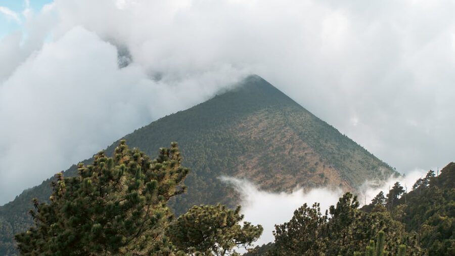
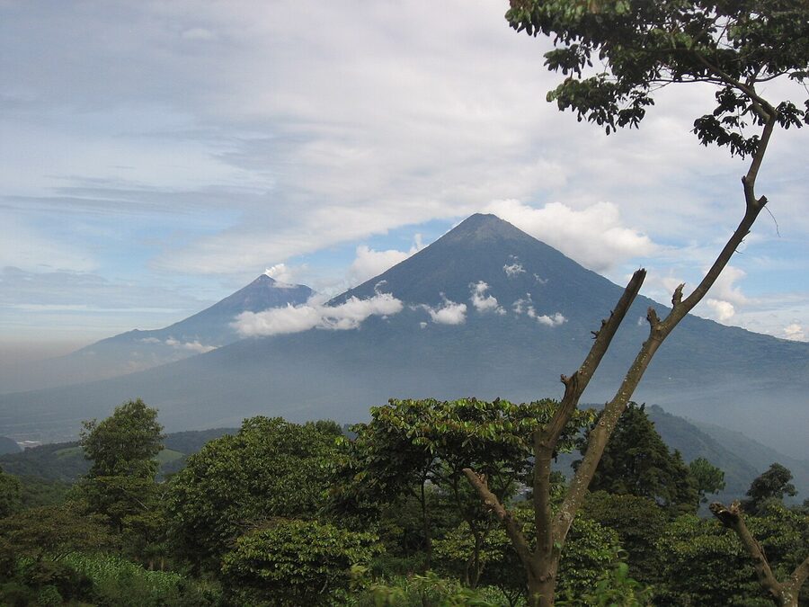
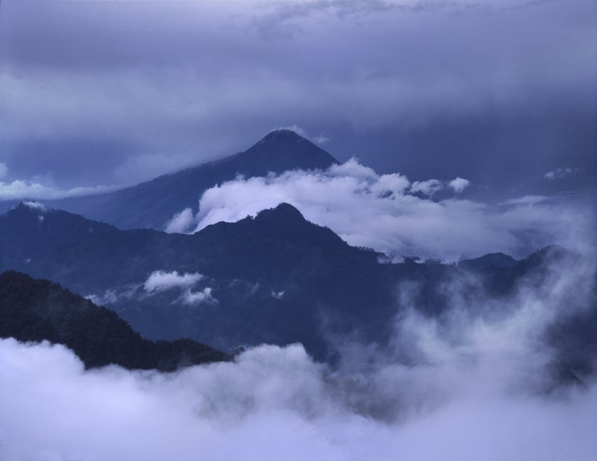
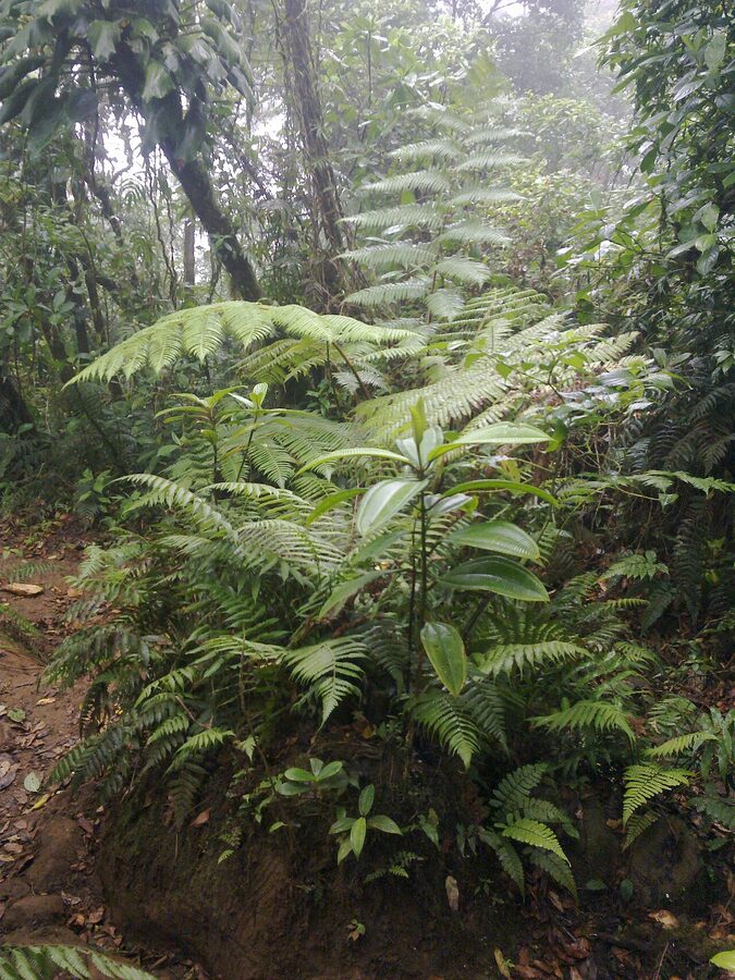
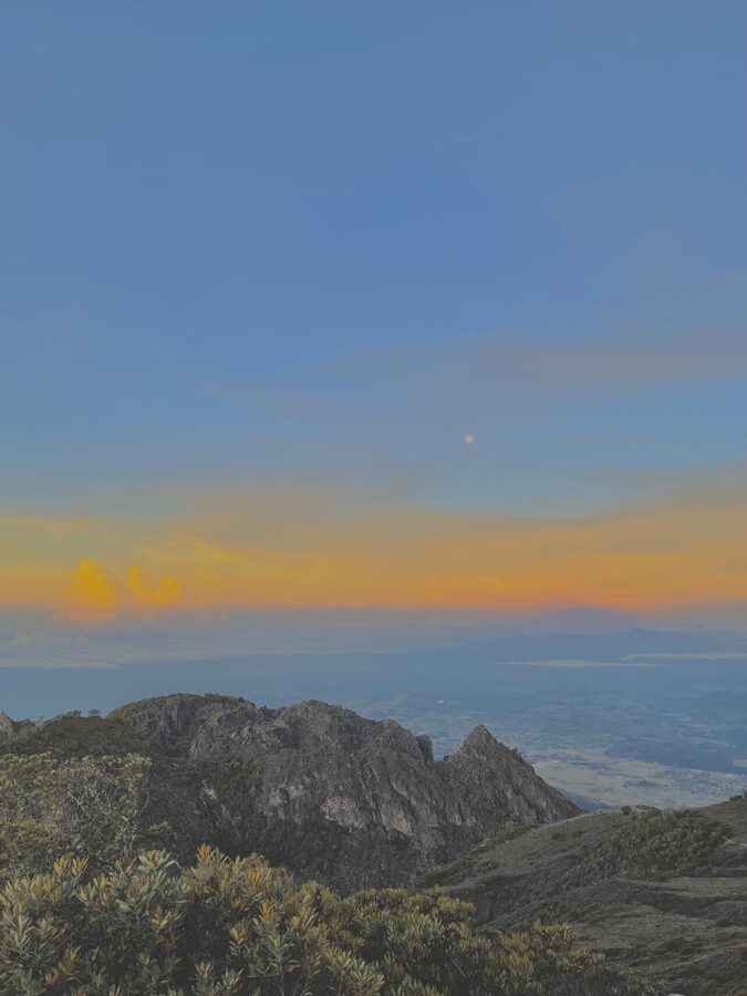
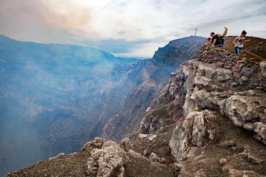
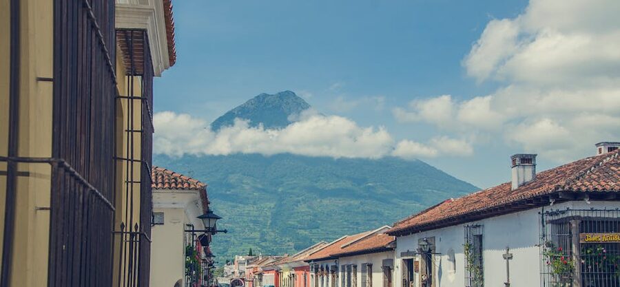
If you do one volcano hike in Central America, do this one. Acatenango sits at 3,976 metres about an hour and a half outside Antigua by minivan, and its only real job is to be the dormant grandstand for its very-active sister, Volcán de Fuego. Fuego erupts every 15 to 30 minutes around the clock. You camp on the saddle between the two cones at around 3,600m, eat a basic spaghetti dinner the porters cook over a fire, and watch lava bombs arc into the sky for as long as you can stay awake. Around 4am the guides wake you for the 90-minute summit push to catch sunrise from the top.
It is not a beginner’s hike. The first three hours from the trailhead at La Soledad are an unrelenting slog through coffee plantations and cloud forest at gradients between 25 and 40 degrees. Above 3,500 metres the path turns into ankle-deep volcanic scree, the sort that has you sliding back half a step for every full step you take. Most fit hikers complete the round trip in 11 to 13 hours over two days. The altitude alone takes a few people out, particularly anyone who flew in to Guatemala and started this hike inside 48 hours.
Outfitters: the established names everyone in Antigua will steer you toward are OX Expeditions, Old Town Outfitters, Wicho & Charlie’s, and Soy Tigre. OX runs the most polished operation: better tents, gear rental sorted, real meals, fluent English guides. Tropicana Hostel runs cheaper trips that get the job done if your budget is tight. The price spread is large because what you’re really paying for is gear quality and food: a Q350 (~$45) tour and a Q650 (~$85) tour are both the same mountain, but in February at 3,600m the difference between a four-season tent and a three-season-with-holes tent decides if you sleep at all. Pay the extra Q300.
One non-negotiable. Do not try this unguided. Two hikers have died on Acatenango in recent years from exposure after getting separated from groups in fog, and the trail above the treeline is genuinely confusing in cloud. Booking with a registered operator also gets you the gear you need, which most travellers do not arrive with: a sub-zero sleeping bag, a thick jacket, gloves, and a head torch. Most outfitters include all three in the package or rent them at the office.
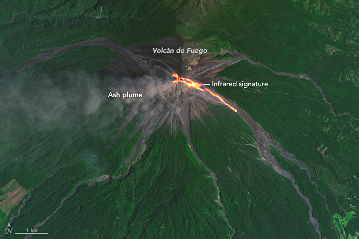
The Fuego add-on hike. Some operators offer a side-trek down off Acatenango and partway up Fuego, getting you within a few hundred metres of the active vent in daylight. It costs an extra Q200 or so, takes about three hours round trip from basecamp, and is genuinely close to lava bombs. After Fuego killed 215 people in the June 2018 eruption, INSIVUMEH (Guatemala’s volcanology institute) and CONRED (civil protection) restrict it during heightened activity. Ask your guide on the day, not in advance.
Best season: November through April for the dry season. Visibility from May through October is a coin flip. Pre-book: Acatenango sells out 1-2 weeks ahead in peak months. Don’t fly into Guatemala assuming you’ll arrange it day-of in Antigua, especially if you only have a tight window.
2. Volcán Pacaya, Guatemala, the easy half-day cousin
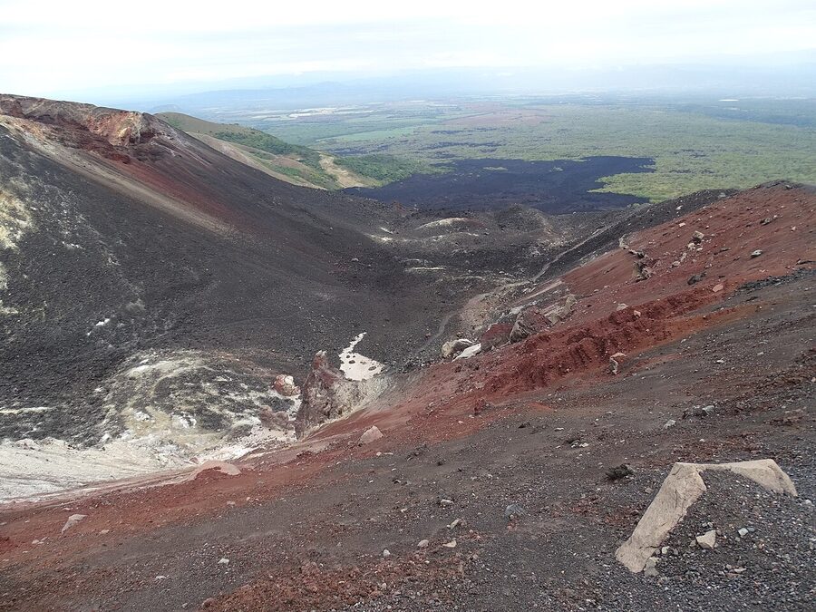
Pacaya is the half-day, low-commitment alternative if Acatenango sounds like too much. It sits an hour from Antigua in the other direction (south, near the Pacific lowland), tops out at 2,552m, and most tours leave Antigua at 6am or 2pm and have you back the same day. The hike itself is two hours up and one hour down on a well-graded path, partly through pine forest and partly across moonscape lava fields from earlier eruptions.
The honest update on Pacaya: it stopped erupting visibly in 2021. For about 15 years before that, hikers could watch glowing lava flowing into rifts on the mountain, and for a while you could roast marshmallows over open lava on the upper slope. As of 2025-2026, the lava has crusted over but the rocks underneath are still hot enough to roast a marshmallow on a volcanic vent. The local guide hands them around at the top. It’s a tourist gimmick at this point, but a fun one, and the lava field is genuinely otherworldly to walk across.
The hard sell at the trailhead is caballo taxis, local kids leading horses, asking around Q150 to ride you up. They will follow your group up the trail for the entire first hour pitching aggressively. Politely refuse if you want to walk, or pay the Q150 if you want to ride. Either is fine. Cost: Q200-250 for a guided tour out of Antigua including transport. Park entry alone if you’re driving yourself is Q100. Add Q40 for a hiking stick rental at the base.
Pacaya is the one I send people on if they have one free morning in Antigua and want to say they’ve climbed an active volcano. It will not blow your mind. But it’s the most accessible volcano experience in Guatemala and the lava-vent picnic is genuinely unique.
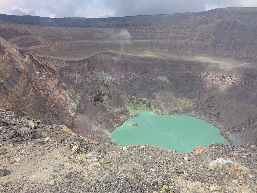
3. Volcán Santa Ana, El Salvador, the turquoise crater
This is the best-value volcano hike in Central America by a long way. The whole thing (round-trip transport, two park entries, mandatory ranger guide, the hike itself) costs about $11 if you do it independently from El Salvador. The summit is a working active crater holding a mineral-saturated lake the colour of mouthwash, and the round trip from the trailhead at Cerro Verde is just under four hours.
The mandatory guide rule has a backstory. Santa Ana sits in Cerro Verde National Park west of San Salvador, near Lake Coatepeque. After a string of armed robberies on the trail in the 2010s, MARN (El Salvador’s environment ministry) and the local policía de turismo moved to a single-window guided-hike system: one departure a day at 11am from the park ranger station, with park staff and police accompanying every group up. Hikers from a 2024 trip note the police escort has been less visible recently as security has improved, but the guides are still mandatory and run only that 11am slot.
The hike itself is moderate. The first half is a forested descent from Cerro Verde down to the base of Santa Ana, giving back elevation before climbing it, which is annoying on the way home but irrelevant on the way up. The second half is a steady switchback climb across loose volcanic rock. About 90 minutes from the top, the trail clears the treeline and you can see Volcán Izalco and Lake Coatepeque off to your right. The summit itself is a wide, exposed rim. The crater lake sits maybe 100 metres below you, glowing turquoise on a sunny day, opaque grey when sulphur fumes thicken. The wind at the rim is fierce. Bring a windbreaker.
Cost breakdown: $0.90 round-trip bus from Santa Ana city to Cerro Verde, $3 park entry at Cerro Verde, $1 guide tip, $6 entry to the volcano park itself ($3 for Salvadoreños). Roughly $11 total. The catch: only one bus runs each direction. The #248 from Santa Ana leaves around 7:40am and the return goes back at 4pm. Miss it and you’re hitchhiking, which is fine here in daylight but worth knowing about. Tour alternative: any tour from San Salvador or La Libertad runs $40-65 with door-to-door pickup; lazy but easy.
One important thing: the hike gets cancelled if winds at the summit are above safe thresholds, regardless of weather lower down. Locals at the trailhead told me a couple turning up that morning had been turned around. Check forecasts and plan a buffer day if you really want this one.
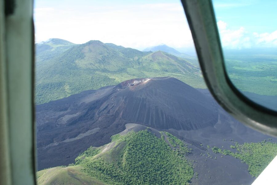
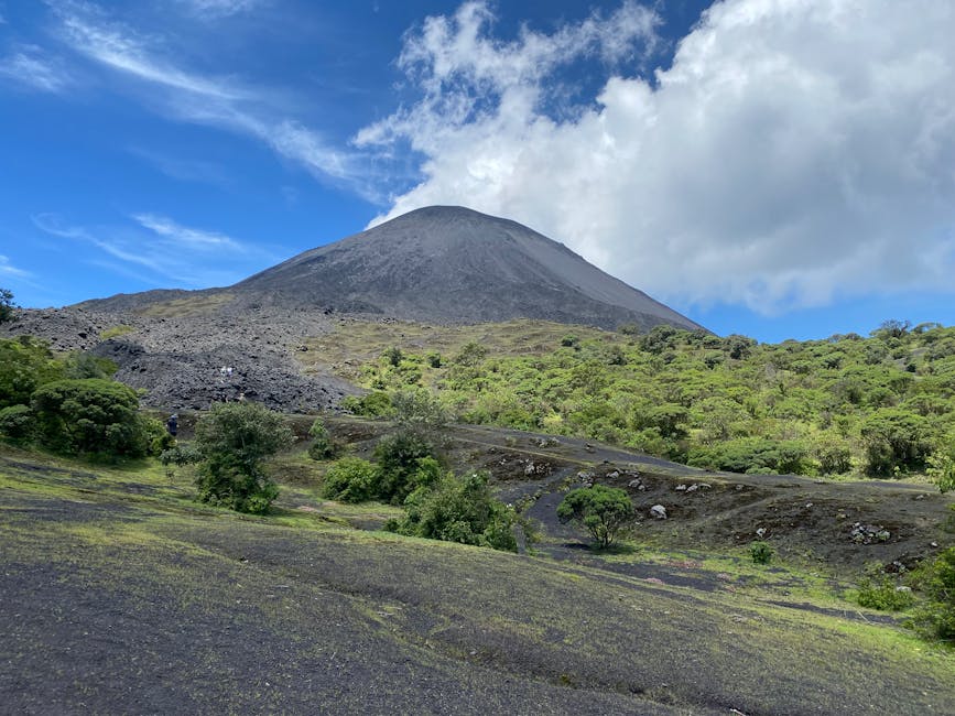
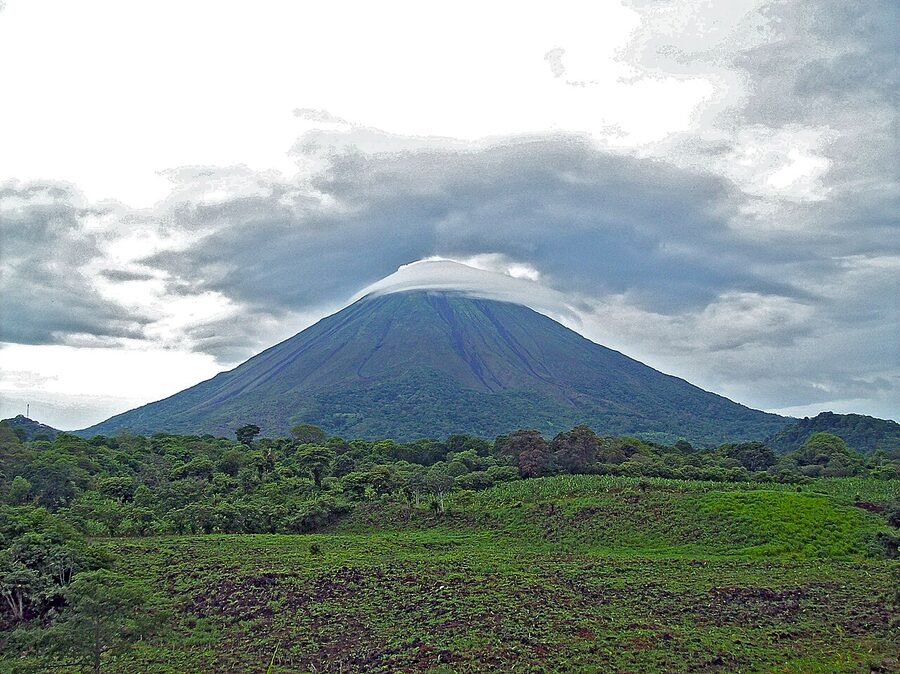
4. Cerro Negro, Nicaragua, volcano boarding

Cerro Negro is a 728-metre cone of black volcanic gravel that rose out of a Nicaraguan farm field in 1850 and has erupted around two dozen times since. It’s one of the youngest volcanoes in the Americas. Climbing it takes about 45 minutes. It is a steep dirt path on one side and the other side is the part that matters. That’s where you sit on a plywood board, push off, and slide down a 41-degree slope of loose volcanic ash, hitting somewhere between 30 and 80 km/h depending on weight, balance, and how much wax is on your board. The unofficial speed record is somewhere around 90 km/h.
This is the most fun half-day you can have on a volcano in Central America, full stop. It’s also the one I recommend for travellers who don’t normally hike. The climb is short, the ride down is genuinely thrilling, and the scenery driving in past the active San Cristóbal and Telica volcanoes is among the best in Nicaragua.
Tours leave from León every morning around 8-9am. Bigfoot Hostel popularised volcano boarding here and still runs the highest-volume operation, including the cult-classic post-hike rum-and-Toña-beer party at the hostel; expect about $30-35 with t-shirt thrown in. Quetzaltrekkers León is the nonprofit alternative; they run the trip for around C$1,000 (~$30) and route the proceeds into a school for vulnerable kids in León. Quality of guiding is at least as good as Bigfoot’s. Tierra Tour is a third reputable option.
Wear clothes you don’t care about. Volcano boarding deposits a fine layer of black ash into every fold, pocket, and ear canal you own. Bring a bandanna for your face. Goggles are usually provided. Photograph your friends sliding down before you go yourself, because you will not be able to take pictures while moving. Most tours cap the day at lunchtime and you’re back in León by 2pm with the rest of the day for León’s cathedral, the Sutiaba market, and a sunset on the rooftop of the basílica.
5. Volcán Concepción, Ometepe, Nicaragua, the toughest day hike
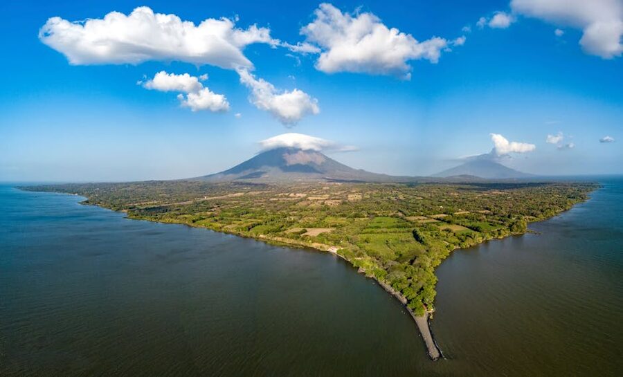
Concepción is the bigger of the two volcanoes that make up Isla Ometepe, the figure-eight island in Lake Nicaragua. At 1,610 metres it’s not particularly tall by Central American standards. What it is, instead, is brutally steep and unrelenting in a way that catches even experienced hikers off guard. Hikers who’ve done Acatenango, the Inca Trail, the Lost City Trek, and Ben Nevis still rate Concepción as the hardest of the lot. The reason: the last 600 vertical metres are a more or less constant 45-degree pitch, with no flats, on uneven scoria. It’s eight to ten hours round trip and around 70% of hikers turn around at the mirador at 1,000m without making the summit.
Mandatory guide. The trail above the mirador is unmarked, the scoria is loose, the wind is fierce, and the guides will tell you matter-of-factly about a three-metre crack in the crater rim that’s expanding annually. People have died trying this independently. Permits are run through the Ometepe guide association and tours can be arranged at any guesthouse on the island, in Moyogalpa town, or via your hostel. Cost is around $25-40 per person depending on group size, plus a $3 park entry paid at the trailhead.
If you base yourself near Moyogalpa on the Concepción side, your pickup is around 6:30am and you’re walking by 6:45. Bring three litres of water (no shops on the trail), a packed lunch, and proper hiking shoes. Trainers are not enough. Carry a windbreaker even if it is hot at sea level. Past 1,000m, the temperature drops and the wind tears through whatever you’re wearing.
Vale la pena? (Is it worth it?) Yes, if you’ve already done some volcano hiking and want a challenge. No if Concepción is your first volcano. The summit views, when you get them, are spectacular: 360 degrees over Lake Nicaragua, the mainland coast, and Volcán Maderas across the isthmus. The catch is that clouds obscure the summit on something like half of all attempts, so the postcard shot of the lake from the top is more rare than you’d assume from Instagram.
6. Volcán Maderas, Ometepe, Nicaragua, the easier sister
Maderas is the sensible choice on Ometepe if you don’t have the legs (or the time) for Concepción. It’s the dormant southern half of the figure-eight at 1,394 metres, climbed via a thick cloud forest that lands you at a small crater lake at the top. Total time is seven to eight hours round trip. The trail is muddy almost year-round (the eastern side of Ometepe gets noticeably more rain than the western) and the last hour involves clambering over tree roots, slick clay sections, and a section of fixed ropes near the rim.
The wildlife pulls Maderas above what its modest summit would suggest. White-faced capuchins and howler monkeys are common. Cicadas are deafening. If you keep your eyes up, you’ll spot mantled howlers slow-moving through the canopy and the occasional toucan. The crater lake at the top is small and often choked with cloud, but on a clear day it’s a quiet, eerie pool surrounded by stunted dwarf forest.
Cost: $20-30 with a guide depending on group size, plus park fee. Guides are technically optional on Maderas (unlike Concepción), but the muddy trail in the rainy season is genuinely dangerous solo and the wildlife knowledge of a local guide is the difference between seeing a sloth and walking right past one. Hire one. Most Ometepe accommodations on the Maderas side, around Mérida and Balgüe, can sort it for you. Best season: December through April. The trail in October is a mud chute.
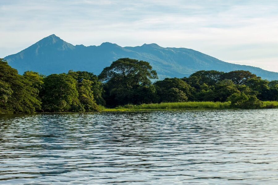
7. Volcán Barú, Panama, the only place you see two oceans
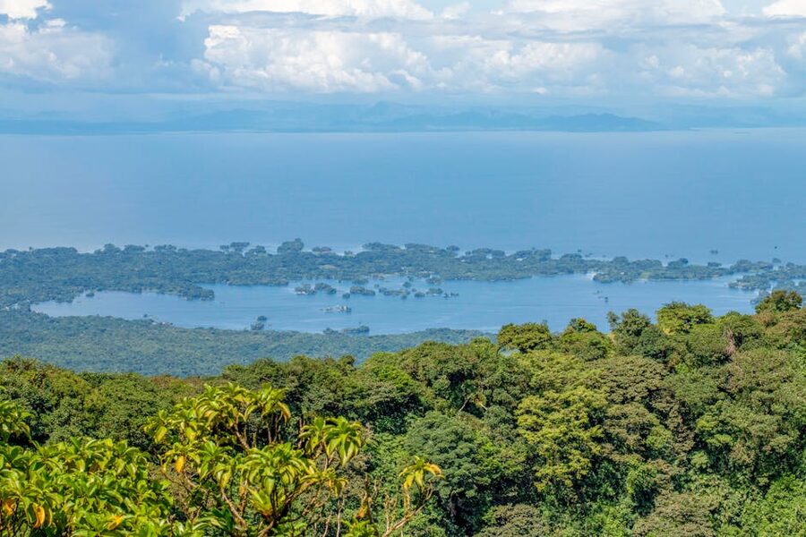
Volcán Barú is the highest point in Panama at 3,475 metres, and on a fully clear morning it’s the only place in the entire isthmus where you can see both the Caribbean and the Pacific from a summit. That alone makes it worth the climb. The catch: those fully clear mornings happen maybe 20% of the time. Most days you get one ocean if you’re lucky.
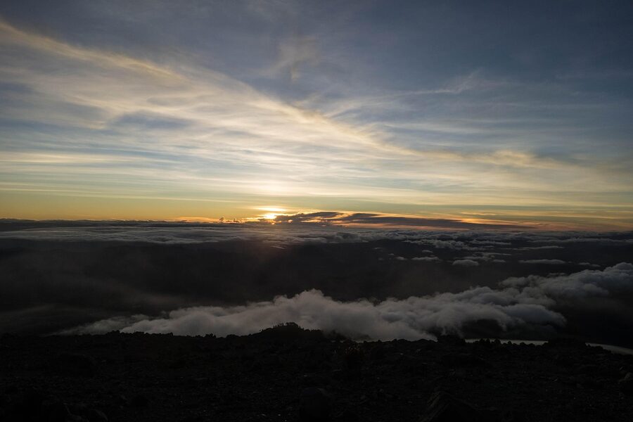
The standard route starts from the trailhead just outside Boquete in the Chiriquí highlands. It’s a 13.5km dirt road that climbs steadily to the summit. Two ways to do it. Option A: drive a 4×4 to the top (it’s allowed, and there’s a road), cruise around for half an hour, drive down. Option B (the proper one): hike up overnight, leaving Boquete around 11pm, summit by sunrise around 5:30am. The hike is moderate in technical terms (it is a road, not a trail), but the elevation gain (around 1,700m) and the cold at altitude make it genuinely tough. Six to nine hours up depending on your pace.
Outfitters: several Boquete operators run guided sunrise hikes, including Boquete Outdoor Adventures, Habla Ya Spanish School Tours, and freelance guides through hostels in town. Cost runs $50-80 per person with transport from Boquete and a guide. The official park entry is $5, paid at the trailhead via SNT (Panama’s national parks system). You can hike independently for that $5 with no guide required, but you’d want to be confident with night navigation; the road forks twice on the way up.
Bring a serious jacket. Summit temperatures in dry season can drop below freezing, and the wind on the rocky upper section is brutal. A head torch with fresh batteries is non-negotiable for the night hike. Many people underestimate this: the lower half of the route is forest and warm, then the air thins, the temperature crashes, and you’re trying to find a trail marker in cloud at 3,200m at four in the morning. Layer up.
8. Volcán Mombacho, Nicaragua, cloud forest day trip from Granada
Mombacho is the easy, scenic, no-suffering option in Nicaragua if Concepción sounds like your worst nightmare. It’s a 1,344-metre cloud forest reserve about 15 km south of Granada, and the trick is that you can ride a 4×4 truck most of the way up. The last hour is a loop trail through dripping cloud forest, with views down to Granada, the islets in Lake Nicaragua, and Laguna de Apoyo on a clear day.
You won’t suffer on Mombacho. Mantled howler monkeys, white-faced capuchins, and three-toed sloths are nearly guaranteed on the upper trail. The reserve’s resident orchids are some of the rarest in Nicaragua. There are four marked trails of increasing difficulty; the standard “Sendero El Cráter” loop takes 90 minutes to two hours.
Cost and logistics: day tours from Granada run around C$1,400 (~$40) including the park truck, an English-speaking naturalist guide, and transport. The reserve is run by Fundación Cocibolca, a respected nonprofit. Independent visitors pay around C$1,100 ($30) at the gate, plus the truck ride up which is roughly C$600 ($17). It’s open Thursday through Sunday only. Show up Tuesday and you are out of luck. Pair with: a coffee tour at one of the fincas on Mombacho’s flank (Café Las Flores has a popular one), or with the boat trip through the islets of Granada.
9. Volcán Masaya, Nicaragua, the lava lake drive-up
Masaya is technically not really a hike. You drive into it, get out, walk five metres to a guard rail, and look down into the active vent. But it’s one of the most accessible places in the world to see actual molten lava, so it earns its spot on this list. The Santiago crater contains a permanent lava lake that glows orange in the dark. The 16th-century Spanish chroniclers called this volcano la boca del infierno (the mouth of hell). They weren’t wrong.
Masaya National Park sits 25 km southeast of Managua, an hour drive from Granada. Day visit cost is C$220 ($6) for foreigners, and you can drive a rental car right to the rim (or take a tour from Granada for around C$700-900). For day visits you get 15 minutes at the rim before the rangers move you on, due to sulphur dioxide concentrations. The night tour is the one to do. It runs from about 5pm to 8pm, lets you stay 30 minutes per visit, and the lava lake actually glows red. Cost is around C$1,400 ($40) including a transport pickup from Granada or Managua. Operators in Granada (try Tierra Tour, Treehuggers, or any Calle La Calzada hostel) sell it.
One note. INETER (Nicaragua’s earth sciences institute) sometimes closes the rim road during high-emission events. There’s a trail option called the Sendero Coyote for hikers who want a proper walk: a 30-minute loop on the old caldera, not the active vent. Most travellers skip it; the lava lake is the show.
10. Volcán Tajumulco, Guatemala, the highest peak
Tajumulco is the highest peak in Central America at 4,220 metres. The name means “above the clouds” in the local Mam language, which is how it generally feels at the summit. It sits in the western highlands near the Mexican border, accessed from Quetzaltenango (everyone calls it Xela), and unlike Acatenango it remains genuinely uncrowded.
This is the Quetzaltrekkers hike. Quetzaltrekkers is a nonprofit out of Xela that runs all-inclusive guided treks on Tajumulco and several other routes (Volcán Santa María, Lake Atitlán crossings, Nebaj). Profits go directly into a project for street kids in Quetzaltenango. The Tajumulco overnight trip runs around Q800-950 (~$100-125) per person and includes everything: gear, transport, a tent, meals, porters, the lot. They lead trips weekly during dry season. It is, hand on heart, the best-run volunteer-led trekking outfit in Central America. Book in person at their office or via their website a few days ahead.
The hike is an overnight: you camp at around 4,000m on the saddle, summit at sunrise, and descend by mid-morning to catch the chicken bus back to Xela. Total walking time is around 9-10 hours over two days. Difficulty is hard but not technical. The issue is altitude. Spending two or three days in Xela (2,330m) before attempting Tajumulco is genuinely necessary. Travellers who skip the acclimatisation routinely turn back at 4,100m with bad headaches.
The reward: the highest summit on the isthmus, and on a clear morning, views across the Sierra Madre into southern Mexico. There’s something quietly satisfying about saying you’ve stood on the highest point in CA. Crowds are minimal: you might see one or two other groups on a weekend. When to go: November through February for the clearest skies and the coldest summit nights. October hikers consistently report wet conditions and thin views.
What about the Costa Rica drive-ups
Costa Rica has more than a dozen volcanoes, including some genuinely active ones, but most of the famous ones are observed rather than climbed. Arenal, the postcard cone near La Fortuna, is closed to summit hikes. It has been off-limits since the 2010 dome collapse and SINAC (Costa Rica’s national parks service) enforces this strictly. You can hike Arenal’s lower flanks on the marked trails in Arenal Volcano National Park, which is a pleasant rainforest walk with hot-springs payoff afterward, but you don’t summit. Cerro Chato, Arenal’s dormant neighbour, was the popular alternative, also closed since 2018 due to landslide risk, with reopening repeatedly delayed. Some hostels in La Fortuna still advertise it; ignore them.
Volcán Poás, north of San José, is a drive-up with a 15-minute walk to a viewing platform over a steaming acid-green crater lake. Entry is around ₡15,000 ($28) for foreigners, booked online via the SINAC website (they don’t sell tickets at the gate). Volcán Irazú is similar: drive to the parking, walk five minutes to the rim. Both are worth a half day if you’re already in Costa Rica‘s Central Valley, but neither qualifies as a hike. Rincón de la Vieja in Guanacaste is the exception: an actual multi-trail park where you can hike up to fumaroles, mud baths, and waterfall pools at the volcano’s base. It’s a fair-weather day-long activity, around $17 entry, and the most rewarding active-volcano experience in Costa Rica that involves real walking.
Where to base yourself for each volcano
If you’re routing a trip around volcano hikes, the geography sorts itself into three clusters and two outliers.
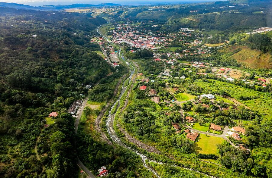
Cluster 1, Antigua, Guatemala. Acatenango and Pacaya both run from Antigua. Stay three to four nights. Most travellers do Pacaya as a half-day on day one (low altitude, good for getting your legs going), then Acatenango as a 2-day on days two and three.
Cluster 2, Granada and León, Nicaragua. Mombacho, Masaya, and the Ometepe pair (Concepción and Maderas) all run from Granada. León is the launch pad for Cerro Negro and the more adventurous Telica overnight. Allow at least a week if you want to do them all, with a ferry crossing to Ometepe in the middle. The shuttle from Granada to León takes about three hours via Managua.
Cluster 3, Boquete, Panama. Volcán Barú is the only major hike out of Boquete, but the town itself is worth a few extra days for coffee tours, the Sendero los Quetzales cross-park hike, and zip-lining in the cloud forest. Panama City is four hours away by overnight bus or 50 minutes by domestic flight.
Outliers: Santa Ana in El Salvador is best done as an out-and-back day from Santa Ana city, La Libertad, or San Salvador. Tajumulco needs Xela as a base; most travellers route Xela on the way between Antigua and Lake Atitlán or as an extension from Lake Atitlán.
If you have only two weeks in the region and want to maximise volcanoes: Antigua (Acatenango + Pacaya), then bus across to Copán (Honduras), down through León (Cerro Negro) and Granada (Masaya night tour, Mombacho day trip), then optionally Ometepe. That’s a hard route but it covers six of the ten on this list.
Safety, eruptions, and weather
Several of these are active. Fuego killed 215 people in June 2018 in the worst Central American volcanic disaster in living memory. Concepción produces ash plumes every few years. Pacaya has had multiple lava flows in the past decade. Masaya is constantly degassing and the rim closes during peaks. None of this should put you off (these volcanoes are climbed safely by tens of thousands of travellers every year), but check current conditions before booking.
Sources to check: INSIVUMEH (Guatemala’s volcanology institute) publishes daily bulletins on Fuego, Pacaya, and Santiaguito. MARN-SNET covers El Salvador’s active volcanoes including Santa Ana and Izalco. INETER publishes Nicaragua data including Masaya gas emissions. The US State Department’s country pages and the UK FCDO travel advice include current advisories where they exist. For Costa Rica specifically, SINAC is the source of truth for park status and ticket sales. Buy tickets through their site or you won’t get in.
For weather, the dry season (verano in local Spanish) runs roughly November through April across most of Central America. May to October is the rainy season; on most volcanoes, this means clouds rolling in by 10am every day and obscuring summits. There are exceptions: the Pacific side of Nicaragua stays drier in shoulder months than the Caribbean side, and Boquete has a unique microclimate where the famous bajareque mist drifts year-round. But as a rule, plan volcano hikes for January through March if you can.
One more thing about altitude
Three of the hikes on this list go above 3,500m: Acatenango, Tajumulco, and Volcán Barú. If you’ve flown in from sea level and are planning to hike one of these inside 48 hours, you will probably be fine, but you may also be one of the 20% of people who get genuinely sick from altitude. Headaches, nausea, sleep disruption, and shortness of breath are all on the menu above 3,000m.
The fix is simple. Spend two to three nights somewhere mid-altitude before the climb. Antigua at 1,500m, Xela at 2,330m, Boquete at 1,200m. Antigua is fine for Acatenango if you take it easy on day one; Xela is genuinely necessary for Tajumulco. Drink double the water you normally would, skip alcohol the night before, and don’t hike if you’re already symptomatic. The Andean coca-leaf trick of chewing leaves doesn’t work on these volcanoes (the indigenous tradition there is different) but ibuprofen helps with the headaches.
For more on planning a volcano-heavy trip across the region, see our broader take in things to do in Central America. If you’re routing through multiple countries, the CA-4 visa rules let you spend up to 90 days across Guatemala, El Salvador, Honduras, and Nicaragua on a single stamp, so you can cluster Acatenango, Santa Ana, Cerro Negro, and Concepción into one trip without immigration headaches.
What I’d actually do, if you only have time for one
If this is your only volcano hike: Acatenango. The combination of altitude, suffering, summit, and Fuego erupting all night is unmatched anywhere else on the isthmus. Book OX Expeditions or Soy Tigre, pay the extra Q300 for the better gear, and don’t try the unguided Reddit shortcut.
If you don’t hike: Cerro Negro. The boarding is the most fun you’ll have on a volcano without spending two days in pain.
If you have a budget of about $11 and a free morning in El Salvador: Santa Ana. The turquoise crater earns the trip on its own.
If you’ve already done Acatenango and want the second-best: Volcán Barú at sunrise, on a clear morning, for the two-ocean shot. Then a long lazy breakfast at a coffee finca in Boquete while your legs recover.
Pack: hiking boots (broken in), a fleece, a waterproof shell, a head torch, two litres of water minimum, sun cream, a buff or bandanna, gloves for the high-altitude ones. Skip: cotton anything, your fanciest camera if it’s an overnight (the ash gets everywhere), and the temptation to do this without a guide. Do book Acatenango ahead. Don’t fly in to Guatemala on a Sunday and start Acatenango on Monday. Give yourself a buffer day.
The volcanoes here have been climbed by Maya, conquistadors, naturalists in the 1800s, and now backpackers and Instagram tourists. They will outlast all of us. The ones that are erupting were erupting before you booked your flight and will be erupting after you fly home. Treat them with respect, hire local guides, tip well, and the experience is one of the genuinely transcendent things you can do in this part of the world.