The first thing people ask when I say I’m heading to El Salvador is whether it’s safe. Two years ago I’d have hedged. Now I just say yes, with a footnote. The country has gone from one of the highest homicide rates in the hemisphere to figures lower than a lot of US cities, and the change happened fast. Bukele’s State of Exception, declared in March 2022, is still running. Tens of thousands of people are in prison without trial. The streets are quiet in a way they genuinely weren’t a decade ago. Both things are true at once, and any guide worth reading has to hold them together.
What that means for you, the traveller, is that El Salvador is now one of the more straightforward Central American trips. The US State Department dropped it to Level 1 (Exercise Normal Precautions) in 2025. Tourism is rising. The infrastructure is still patchy, English is patchier, and the bus system runs on its own logic. But the world-class point breaks at Punta Roca and El Sunzal, the turquoise crater lake at the top of Volcán Santa Ana, the painted mural towns of the Ruta de las Flores, and the buried Mayan farming village at Joya de Cerén are all here, and you can string them together in seven to ten days without trying very hard.
I’m going to be straight about what’s worth your time, what to skip, and where to be cautious anyway. El Salvador is the smallest country in Central America and one of the most underrated, but it isn’t yet a country where you can switch your brain off. You don’t need to. You do need to bring some Spanish, some flexibility, and a willingness to take a chicken bus or two.
In This Article
- Is El Salvador actually safe? The Bukele question
- When to go
- How long do you need?
- Getting there
- Money, language, food
- San Salvador
- The surf coast: El Tunco, El Sunzal, La Libertad, El Zonte
- Volcán Santa Ana: the hike everyone does
- Santa Ana the city, and Lago de Coatepeque
- Suchitoto
- The Ruta de las Flores
- Mayan ruins: Joya de Cerén and Tazumal
- El Imposible National Park and the western forests
- A practical 7 to 10 day itinerary
- Cross-border: CA-4 and what’s around
- What I’d skip, what I’d do twice
- Final word
Is El Salvador actually safe? The Bukele question
Here’s the short version. From the late 2000s through about 2021, El Salvador had one of the worst gang-violence problems in the world. MS-13 and Barrio 18 controlled neighbourhoods, ran extortion rackets, and made parts of San Salvador’s suburbs no-go areas after dark. In March 2022, after a weekend with eighty-seven murders, President Nayib Bukele declared a régimen de excepción (State of Exception). Tens of thousands of people were arrested, often without warrants. A new mega-prison was built. By 2024 the homicide rate had collapsed to numbers comparable with Switzerland.
The State of Exception is still in place. Human-rights groups, Amnesty International, and the UN have flagged due-process concerns and reports of mistreatment. Several foreign citizens have been detained. The State Department’s current advisory says exercise normal precautions but flags this directly, and the UK’s FCDO guidance is in the same range. As a tourist sticking to tourist places, you will almost certainly never see any of this. Locals you meet will have opinions. Some lost a family member to gangs and credit Bukele with bringing peace. Others lost a family member to the mass arrests and feel very differently. Listen, don’t argue, don’t post strong political opinions on local social media. Treat it the way you’d treat any country running a long-term emergency law.
For practical purposes: San Salvador’s tourist zones (Zona Rosa, Colonia San Benito, the renovated Centro Histórico during the day), the surf coast, Santa Ana, Suchitoto, and the Ruta de las Flores are fine. Walk around, eat street food, take buses. The suburbs of Soyapango, Apopa, and Mejicanos are still rougher than the rest of the city and you have no reason to be there as a visitor. Don’t drive at night between cities if you can avoid it. Don’t hitchhike. Use registered taxis, Uber (works in San Salvador and the surf towns), or InDriver. Carry a copy of your passport, not the original.
When to go
Two seasons, no real shoulder. November through April is dry, hot, dusty toward the coast and surprisingly cool at altitude (Suchitoto and the Ruta de las Flores towns sit between 600 and 1,400 metres and the evenings need a layer). May through October is rainy, which here means a clear morning and a heavy late-afternoon downpour most days, with greener landscapes and far fewer tourists. The hot months are March and April. You can melt walking around El Tunco at midday in late March.
The complication: the surf is best in the wet half of the year. The biggest, cleanest swells along the El Sunzal and Punta Roca reefs come between April and October. World Surf League Championship Tour events run on the Salvadoran coast in those months. So if you’re surfing, go in the wet season and accept that some days you’ll get rained out of the volcano hike. If you’re not surfing, dry season is easier. December and January are perfect and also the busiest. February and early March are my pick.
How long do you need?
Seven days is the practical minimum and gets you San Salvador, the surf coast, Santa Ana plus the volcano hike, and a Suchitoto day trip. Ten days adds a proper run along the Ruta de las Flores. Two weeks lets you tack on Joya de Cerén, Tazumal, El Imposible National Park, and a quieter beach east of La Libertad. The country is small (about the size of Massachusetts) and you can usually get from any one of these to any other in three hours or less.
If you’re putting it inside a longer Central American trip, the natural connections are: cross over from Guatemala at Las Chinamas (from Antigua, about five hours by shuttle), or come up from Costa Rica through Honduras via El Amatillo. The CA-4 visa makes the Honduras and Guatemala (and Nicaragua) connections free of separate stamps. More on that below.
Getting there
One international airport: San Óscar Arnulfo Romero (SAL), about forty minutes south of the capital and roughly the same west to the surf coast. Direct flights run from Miami, Houston, Dallas, Los Angeles, Atlanta, New York, San Francisco, and several other US gateways. Avianca runs the Toronto route. Flights from Europe almost always connect through Madrid, Bogotá, or a US hub.
An Uber from SAL to San Salvador or El Tunco runs about $30 to $40. The local airport bus to San Salvador is roughly $1, leaves frequently, and works fine in daylight. If you’re arriving late at night with a backpack, just take the Uber.
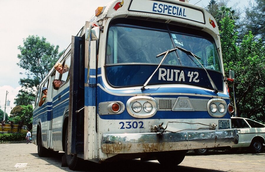
Overland into El Salvador, the working borders are: Las Chinamas from Guatemala (best for Antigua and the Ruta de las Flores side), La Hachadura on the Pacific (better for surfers heading straight to the coast), Anguiatú further north, El Amatillo from Honduras (the busiest, gateway from Tegucigalpa and the south), and El Poy further north from Honduras. Tourist shuttles like Gekko Trails Explorer run Antigua to El Tunco direct. Chicken buses cross the borders too but you change vehicles at the line and it eats most of a day. The Tica Bus runs San Salvador to Tegucigalpa, Managua, and onward, but it’s not the cheapest option for short hops.
Money, language, food
El Salvador adopted the US dollar as its official currency in 2001, replacing the colón, and prices everywhere are in USD. State that fact and forget about it. Bitcoin is also legal tender, since 2021, and you’ll see Chivo Wallet ATMs in some towns and a few cafés that accept it. Most locals never use it. You’ll never need to. Cash works for everything; cards are accepted in San Salvador, the surf towns, and the bigger Ruta de las Flores cafés but not in rural comedores. Bring small bills and dollar coins (yes, dollar coins are in heavy circulation here, which catches Americans off guard).
Spanish is the official language. English is patchy outside surf towns and tourist hotels. A receptionist or a tour guide will usually have enough to get you through; a chicken bus driver, a comedor cook, or a market vendor probably won’t. Learn enough to order a meal, ask directions, and negotiate a tuk-tuk fare. Locals are friendlier when you try.
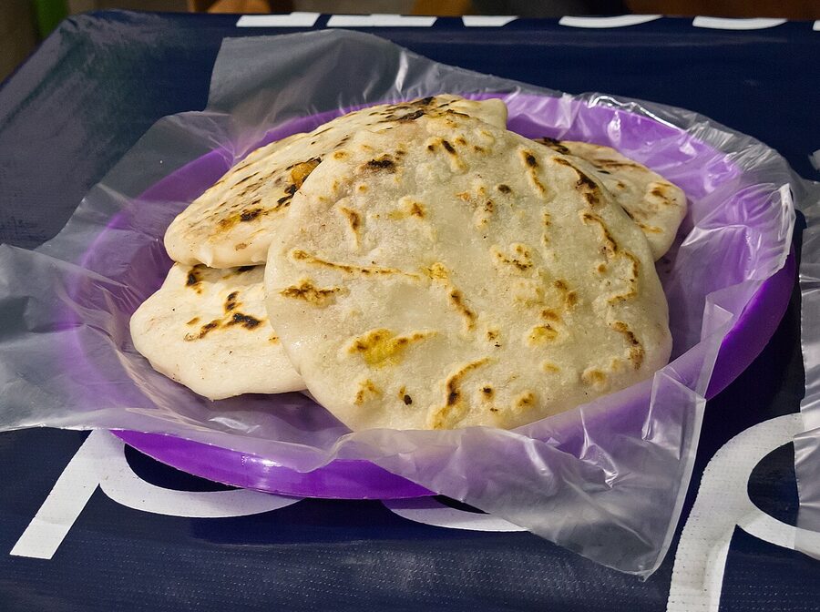
The food deserves its own section. Pupusas are the national dish. Thick handmade corn (or rice) tortillas stuffed with chicharrón and beans, with cheese and loroco (an edible flower bud), or with revuelta (everything). Three of them with curtido (pickled cabbage) and salsa roja runs about $2 at a roadside pupusería and feeds you. Yuca frita con chicharrón, fried cassava with pork crackling, is the hangover food. Pan con pavo is a turkey sandwich with a dark spiced relish, which sounds dull and isn’t. Atol de elote, a warm corn drink, turns up at markets in the cooler towns. Sopa de gallina india is free-range chicken soup with a much deeper flavour than the broiler stuff. Salvadoran refried beans are made from red beans, not pinto, and taste better. Pilsener and Suprema are the local lagers; both are fine, both come in big bottles for $1.50.
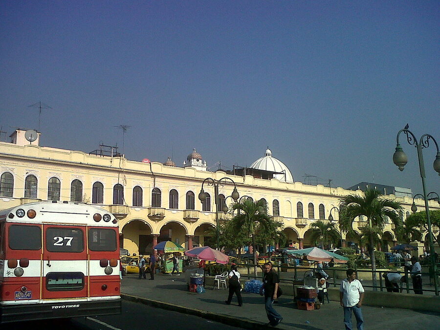
San Salvador
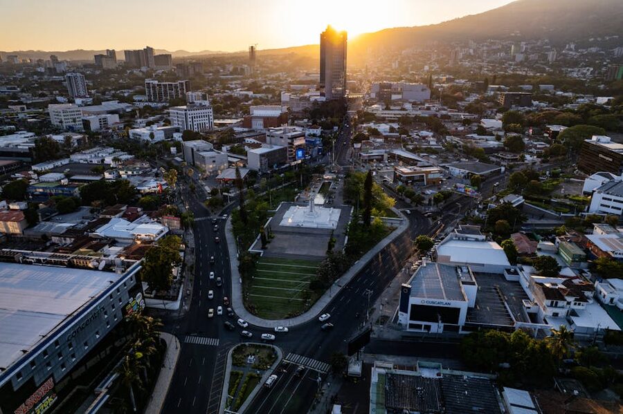
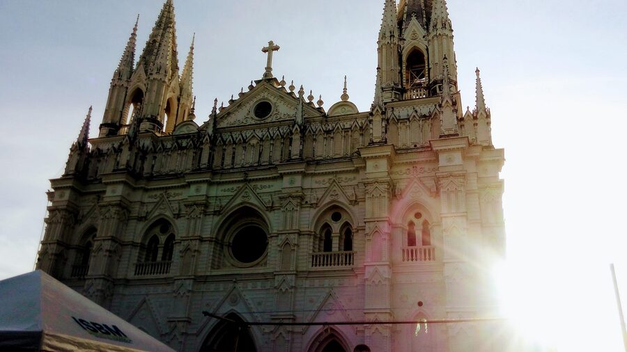
The capital gets shrugged off in most itineraries and that’s fair, in part. It’s a sprawling city of around 1.8 million in the metro area, hot, traffic-heavy, and not pedestrian-friendly outside specific zones. But it’s where you’ll land, where Plaza Libertad and the Catedral Metropolitana sit, and where you find some of the best coffee and food in Central America. Two days is plenty.
Stay in Zona Rosa or Colonia San Benito. Both sit in the western part of the city near the Monumento al Salvador del Mundo, are heavily policed, and are walkable in daylight and most evenings. Zona Rosa is more nightlife and shopping malls (Multiplaza); San Benito is leafier and quieter, with embassies, the MARTE art museum, and the Museo Tin Marín. Hostal Cumbres del Volcán Flor Blanca is a long-running budget option. Mid-range, the Crowne Plaza and Sheraton Presidente are reliable. La Zona Hostel is the backpacker default.
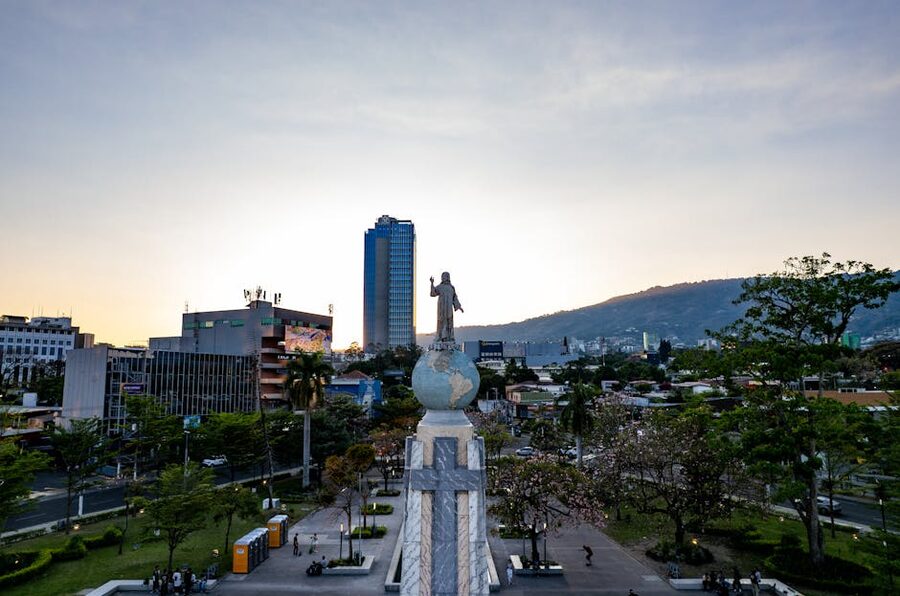
The renovated Centro Histórico is the genuine surprise. Five years ago it was unsafe; today it’s been substantially cleaned up, repainted, and policed. Plaza Libertad, the Catedral Metropolitana (where Saint Óscar Romero is buried in the crypt), the Teatro Nacional, the Palacio Nacional, and the BINAES national library are all walkable in a morning. Go in daylight, ideally weekday morning, and trust your usual city instincts. Don’t wear an expensive watch.
Food and coffee: Alquimia Coffee in San Benito is currently the best cup in the country and has been written up in international “world’s top hundred” lists (whatever those are worth). Cadejo Brewing Company runs the only proper craft brewery; their taproom in Zona Rosa is a good first-night spot. Andián Bistro & Café does excellent gelato. For a sit-down dinner, Delikat in San Benito is reliable; for a bigger night, Republik Bar.
Day trips from the capital: Puerta del Diablo (about thirty minutes south, dramatic rock formation with valley views, $1 to enter, careful on the cliffs), Los Planes de Renderos (cooler hilltop neighbourhood famous for pupusas with a view), Lago de Ilopango (a crater lake roughly the size of Coatepeque, less developed, lakeside seafood at Las Tres Pedras). Joya de Cerén and Tazumal are doable as a long day trip, though you can also build them into a Santa Ana base.
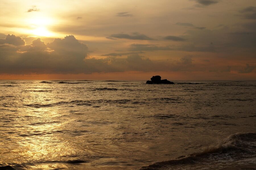
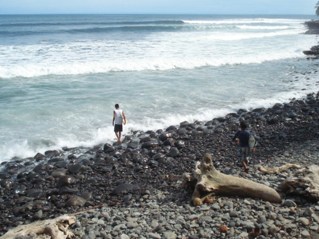
The surf coast: El Tunco, El Sunzal, La Libertad, El Zonte
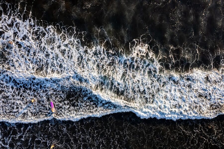
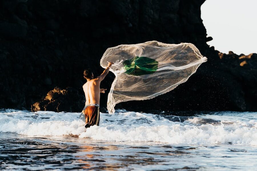
El Salvador’s Pacific coast is the part of the country international visitors hear about first, and for good reason. The right-hand point break at Punta Roca, just east of La Libertad, is consistently rated one of the best in Central America, and you can ride the same wave that pros are riding for the price of a bus ticket and a board rental. The lineup is busier than it was a decade ago but it’s nothing like Tamarindo or Sayulita; locals are still the majority and they’re not territorial unless you’re a beginner trying to drop in.
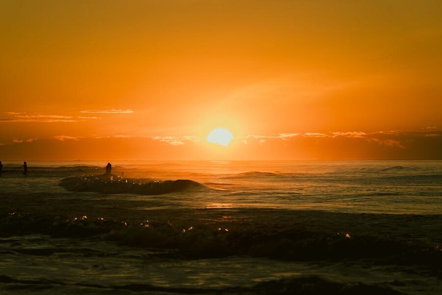
El Tunco is the social hub. Tiny town, single main strip, every other building is a hostel or a smoothie bar. The break right in front of town is a beginner-friendly beach break; serious surfers walk fifteen minutes east to El Sunzal (a long, mellow point) or get a tuk-tuk to Punta Roca. Sunset on the beach with a Pilsener is the daily ritual. Live music at Mopelias on Tuesday is a good night out. Papaya Lodge and La Tortuga Verde sister property here are solid hostels.
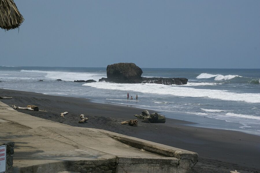
El Sunzal is for the surf itself. Less party, more boards. La Libertad is a real working port town with a long fish market on the pier (best in the country, go in the morning), Punta Roca breaking just to the east, and a less polished feel than El Tunco. El Zonte, twenty minutes west, is quieter and known internationally as Bitcoin Beach (a 2019 grant-funded experiment that put crypto into the local economy). The waves are mellower, the vibe slower, the sunsets better, and the hostels include Esencia Nativa and Palo Verde. If El Tunco feels too loud after one night, move down here.
Surf logistics: A board rental runs $10 to $15 a day. Lessons are $25 to $40 for ninety minutes including the board. Wayo Surf School in El Tunco and Bamboards Surf Academy are well-reviewed defaults. Don’t sleep on Mizata further west if you have a car; it’s emptier and the wave is excellent.
What to skip: Costa del Sol is a long sandbar east of La Libertad popular with weekending Salvadorans. The hotels there are fine but the surf is mush and the area has none of the energy of the El Tunco strip. Unless you’re looking for an empty beach with a pool, give it a pass.
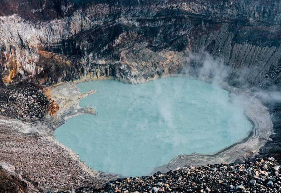
Volcán Santa Ana: the hike everyone does
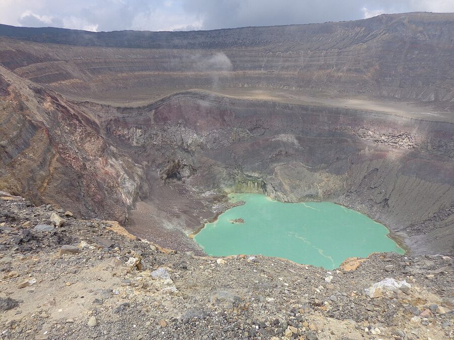
Volcán Santa Ana, also called Ilamatepec, is the highest active volcano in El Salvador at 2,381 metres. It last erupted in 2005, is closely monitored, and has a turquoise crater lake at the top that you can stare straight down into. The hike is the single most-photographed thing in the country and worth the hype.
The trail starts in Cerro Verde National Park. The park gate opens early; hikers must start with a park-mandated guide group at 11am sharp (this used to be earlier and has shifted recently, so check on arrival). The hike is around four hours round-trip, gains roughly 500 metres, and ranges from cloud-forest path to volcanic gravel scree near the rim. Most people of average fitness make it. Bring water (the cloud forest is humid, the rim is exposed), a layer (it can be cold and wind-blasted at the top even when San Salvador is roasting), and decent shoes (no flip-flops). Park entry is around $3, the mandatory guide is included or runs another few dollars.
The simplest way is a day tour from San Salvador or Santa Ana. From the capital it’s a 6:30am pickup, two hours of driving, the hike, lunch at Lago de Coatepeque, and back to the city by early evening for around $50 to $75 depending on group size. From Santa Ana the same tour costs less because the bus ride is shorter. You can also do it independently by chicken bus (San Salvador to Santa Ana, then a bus to El Congo and the park), but the timing only works if you stay in Santa Ana the night before.
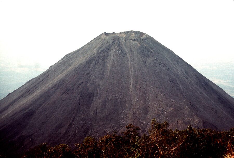
What you actually see: the cloud-forest section is short and thick with epiphytes and birdsong. Then you climb out of the trees into volcanic scree that crunches underfoot. The rim is sudden. There’s no railing. The crater drops straight down to a milky turquoise lake that’s smoking with sulphur on most days. You wait for the gas to clear and you take a photo and you stand back from the edge because there is nothing between you and the lake but air. From the rim on a clear day you can see Lago de Coatepeque on one side, the Pacific in the distance, and the perfect cone of Volcán Izalco on the other.
Santa Ana the city, and Lago de Coatepeque
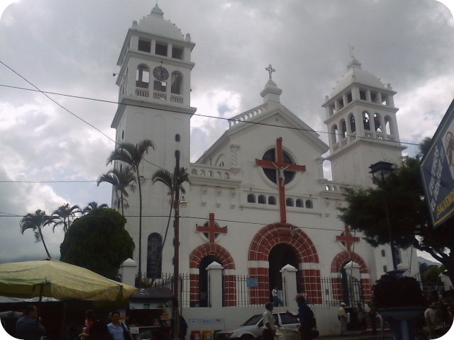
El Salvador’s second city is calmer, hotter, and more colonial than the capital, with the country’s most beautiful church (Catedral de Santa Ana, neo-Gothic, built between 1906 and 1959) on a leafy main square, and the Teatro de Santa Ana from 1910 a block away. The city itself is one walkable afternoon. The reason to base here is access: Volcán Santa Ana, Lago de Coatepeque, the Ruta de las Flores towns, Joya de Cerén, and Tazumal are all within an hour or two. Hostal Casa Verde (run by Carlos for years; rooftop pool, communal kitchen) is the long-running backpacker favourite and the prices are still reasonable.
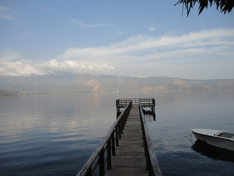
Lago de Coatepeque is a massive crater lake about thirty minutes from Santa Ana, ringed by volcano slopes and edged with weekend houses. Most of the shore is private, but several restaurants offer day passes to their pools and lake access for around $5 to $15. Captain Morgan Hostel sits right on the water and rents kayaks. Restaurante Las Palmeras and La Pampa do good lake-view lunches; mojarra (whole grilled tilapia) is the dish to order. The lake colour shifts from deep navy to bright emerald depending on the sun. Don’t try to swim from the public access points; the water drops off fast.
Suchitoto
Suchitoto is the country’s prettiest colonial town. Cobblestone streets, whitewashed walls, a single church (Iglesia Santa Lucía, mid-1800s) on a square that fills up Sunday mornings with weekenders from the capital. It sits about an hour and a half north-east of San Salvador, on the edge of Lago Suchitlán, a long artificial reservoir that pulls in migratory birds in the cooler months.
One day works. Two if you’re slowing down on purpose. Walk the streets, eat at one of the small restaurants on the square (La Lupita del Portal does a solid set lunch), visit the Centro Arte para la Paz in the old convent (worth it for the civil-war history, which is much more present here than in the capital; the surrounding hills were a guerrilla stronghold in the 1980s). Indigo-dyeing workshops are a local craft tradition; several places offer hands-on classes. From the lakeshore, boats run to a small island called Isla de los Pájaros for around $5 to $10 a person. The waterfall hike at Salto Los Tercios, a strange basalt-column formation, is a half-day from town.
Some travellers skip Suchitoto if they’ve already done Antigua in Guatemala. They overlap, and Antigua wins on scale. But Suchitoto wins on quiet. If you’ve got the time, go.
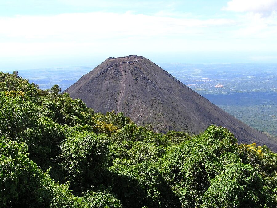
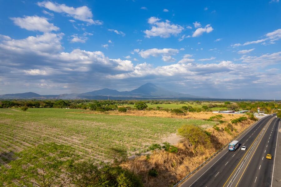
The Ruta de las Flores
Five small coffee-country towns strung along about thirty-six kilometres of mountain road in the western department of Sonsonate and Ahuachapán: Nahuizalco, Salcoatitán, Juayúa, Apaneca, and Concepción de Ataco. The “flowers” name comes from the bougainvillea and wildflowers that line the road in November and February. The route is also the country’s coffee heart, sitting at 1,200 to 1,400 metres on the slopes of the Apaneca-Ilamatepec range, with cool mornings and warm afternoons.
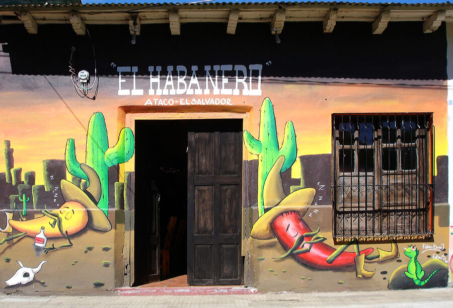
Each town has a personality. Juayúa hosts a weekend food festival (the Festival Gastronómico) every Saturday and Sunday in the central plaza, with grilled meats, exotic-meat stalls (rabbit, frog, sometimes iguana), pupusas, and atol. It’s also the base for the Seven Waterfalls hike, $10 to $15 with a mandatory local guide, half a day, swimming holes at most stops, ropes for the steeper sections. Apaneca has the highest elevation, the coldest mornings, and the Cafetalón coffee farm tours. Concepción de Ataco is the visual headliner: every wall is painted with a mural, and on Sunday evenings the streets fill with vendors, families, and live marimba. Café Albania on the road outside Ataco has a popular zip-line and a ridiculous rainbow slide that will cost you $10 and is mostly an Instagram thing. Nahuizalco has an evening night market with handicrafts; Salcoatitán is the smallest and easiest to skip if you’re tight on time.
You can do the route as a single long day from Santa Ana or San Salvador (organised tours run $40 to $80 a person, including transport and lunch), but I’d give it two nights if you can. Sleep in Ataco or Juayúa to catch the evenings. Hostal de Mamapan in Ataco is small and characterful; Anáhuac in Juayúa is the long-running budget option. Coffee-farm tours run $10 to $25, and the coffee here is excellent (you’ll see why El Salvador exports a lot of premium beans despite producing relatively little volume by Central American standards).
Mayan ruins: Joya de Cerén and Tazumal
El Salvador isn’t on the Mayan circuit the way Copán Ruinas in Honduras or Tikal in Guatemala are, but it has two genuinely interesting Mesoamerican sites that are worth a half-day each.
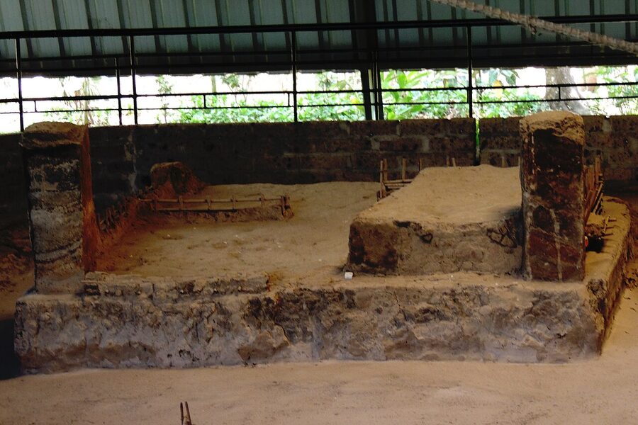
Joya de Cerén is the more important. It’s a UNESCO World Heritage Site (the only one El Salvador has), about thirty kilometres west of San Salvador near the town of San Juan Opico, and it’s known as the Pompeii of the Americas. Around 600 CE, the Caldera Volcano erupted and buried a small Mayan farming village under ash within hours. The villagers escaped, but their houses, kitchens, communal sauna (temazcal), planted fields, and tools were sealed in place. Excavation began in 1976 and is ongoing. The site is small, twelve to fifteen visible structures under modern protective canopies, and not much to look at if you’re expecting a pyramid. What’s special is that this is the only intact Mayan farming village ever found. Most Mayan archaeology is about kings and temples; Joya de Cerén is about ordinary daily life, frozen mid-meal. Entry $7. There’s a museum on site that explains it well; allow ninety minutes. Do not skip the museum or you won’t understand what you’re looking at.
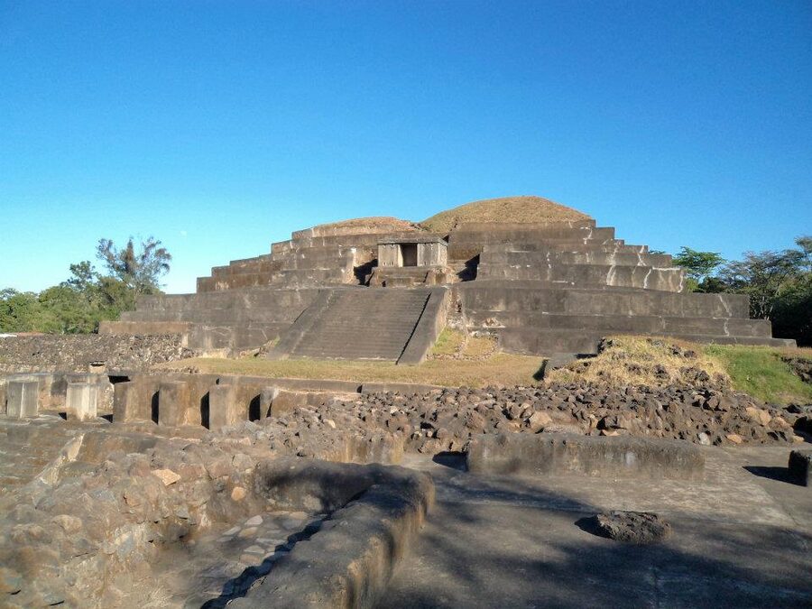
Tazumal, in the town of Chalchuapa about an hour west of Santa Ana, is the more visually impressive of the two: a stepped Mayan pyramid roughly twenty-four metres tall, occupied from around 100 to 1200 CE. The complex is small (you’ll cover it in an hour) and partially restored, but it’s an actual climb-it pyramid in the middle of a busy town, and you can usually have it almost to yourself. The on-site Stanley Boggs museum has the best collection of Mayan artefacts in the country. Entry $5. Combine with Joya de Cerén in a single long day from Santa Ana or San Salvador.
If you’ve already done Copán or Tikal, Tazumal will feel small. Joya de Cerén still won’t, because there’s nothing else like it in the region.
El Imposible National Park and the western forests
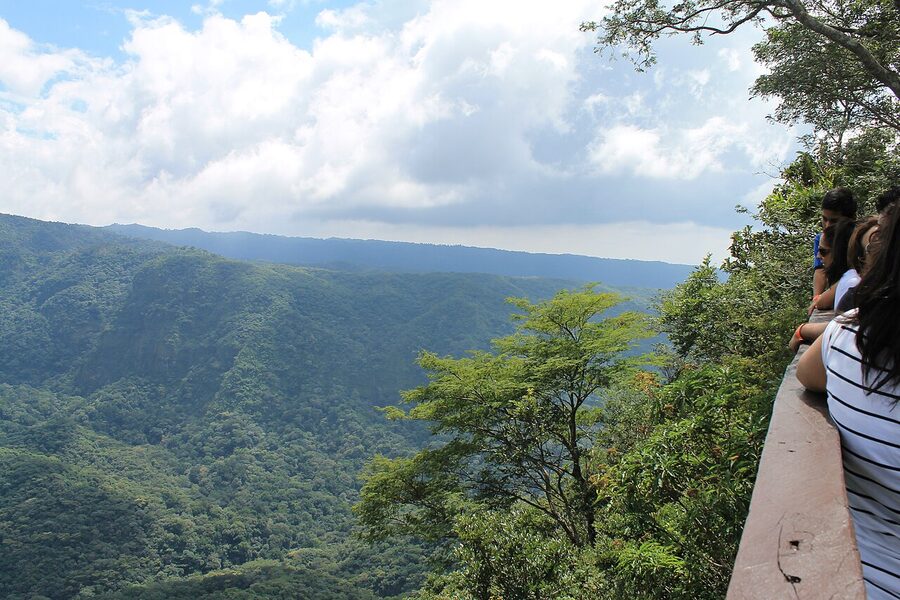
El Imposible National Park is the largest protected area in the country, on the Pacific slope of the Apaneca-Ilamatepec range, west of the Ruta de las Flores. It’s tropical mountain forest at altitude, with eight rivers, several waterfalls, and the country’s best concentration of biodiversity (more than five hundred tree species, four hundred bird species, pumas and ocelots if you’re lucky and quiet). The name comes from a steep historical mule path through the gorge that killed enough animals to earn it the label. A bridge fixed that in 1968, but the name stuck.
You need a guide for any real hike (this is enforced; no solo trekking). Park entry is $6, plus around $10 for the guide. Day hikes from the southern entrance at San Benito are doable; longer overnights are possible with the ranger lodge. The park is quiet, often overlooked by visitors who fill their time with the volcano and the surf coast. Go if you’ve got the days and you care about birds.
Montecristo Cloud Forest in the far north-west, where the borders of El Salvador, Guatemala, and Honduras meet (the Trifinio point), is even harder to reach and is closed to visitors during nesting season (May to October). If you can hit the dry-season window and have a 4×4, it’s the densest cloud forest in the country.
A practical 7 to 10 day itinerary
This is what I’d actually do, given a clean slate and a return flight from SAL.
Day 1. Land in San Salvador. Uber to Zona Rosa or San Benito. Walk to the Monumento al Salvador del Mundo. Coffee at Alquimia. Early dinner. Sleep.
Day 2. Centro Histórico walking morning (Plaza Libertad, Catedral, Teatro Nacional). Lunch at the Mercado Central. Afternoon at MARTE or the Museo Tin Marín. Cadejo brewery in the evening.
Day 3. Bus or shuttle to Santa Ana (about ninety minutes from San Salvador, $1.50 chicken bus, $5 ejecutivo). Check in to Casa Verde. Walk the cathedral square. Casado for dinner.
Day 4. Volcán Santa Ana hike. Lago de Coatepeque lunch on the way back. Beer in the Santa Ana plaza at sunset.
Day 5. Tazumal in the morning, Joya de Cerén in the afternoon. Bus back to San Salvador or onward to the Ruta de las Flores.
Day 6. Ruta de las Flores: base in Ataco or Juayúa. Coffee farm tour, Seven Waterfalls hike from Juayúa, Ataco mural walk in the late afternoon.
Day 7. Bus to El Tunco. Beach. Surf lesson if you want one. Sunset at the rocks.
Days 8 to 10 (if you have them). El Sunzal or El Zonte. A waterfall day trip from El Tunco (Tamanique falls, half a day with a guide, $10 to $15). Quiet day at the beach. Bus back to SAL for your flight.
If you have fourteen days, slot in Suchitoto between San Salvador and Santa Ana, and add a couple of days for El Imposible.
Cross-border: CA-4 and what’s around
El Salvador is part of the CA-4 Border Control Agreement together with Guatemala, Honduras, and Nicaragua. The four countries share a single 90-day tourist stamp; you don’t get a fresh ninety days each time you cross. If you entered Guatemala, then crossed into El Salvador, your clock keeps ticking on the original entry. Plan accordingly. To reset, you have to leave the CA-4 zone (Belize, Mexico, Costa Rica, Panama) and re-enter, with a typical 72-hour exit minimum.
The natural cross-border combinations:
El Salvador to Guatemala (Las Chinamas border): About four to five hours by tourist shuttle to Antigua. Easiest from Ataco or San Salvador. Connects directly to Lake Atitlán via Antigua and onward to Tikal. The cross-border combo with the El Salvador region’s coffee country and Guatemala’s highlands is one of the best two-week trips in Central America.
El Salvador to Honduras (El Amatillo border): The busiest crossing, used by everyone driving the Pan-American. Onward to Tegucigalpa in five hours, or up to Copán Ruinas via San Pedro Sula. The El Poy crossing further north is closer to Suchitoto and gets you to the western Honduran coffee country faster.
El Salvador to Nicaragua: Not a direct land border. You either cross through Honduras (El Amatillo, then El Guasaule into Nicaragua) or take a flight from SAL to Managua. The boat across the Gulf of Fonseca is theoretically possible and rarely worth it for travellers.
What I’d skip, what I’d do twice
Skip: Costa del Sol unless you want a beach resort with pool. The Bitcoin Beach hype as a reason to visit El Zonte (the surf is the reason; the crypto is just a thing that’s there). Cihuatán ruins unless you’re a completionist; Joya de Cerén and Tazumal are better. The “Bitcoin Beach experience” tour. Most of the tours sold out of fancy hotels in San Salvador are overpriced compared to going independently.
Do twice: The Volcán Santa Ana hike, on a clear day. Sunset at El Tunco. The pupusería opposite the Juayúa church. The morning fish market at La Libertad. Coffee at Alquimia. Anything in Ataco on a Sunday evening with the marimba going.
Final word
El Salvador is one of those places where the timing matters. The window where it’s a “just been opened” destination, where the hostels are still family-run and the surf lineup is mostly local and the prices haven’t caught up to Costa Rica yet, is small and probably closing. If you’ve been thinking about it, go now. Pack a basic Spanish phrasebook and an open mind about the politics. Get out of San Salvador early. Eat the pupusas everywhere. Take the chicken bus at least once.
And then you’ll do what most people who come here end up doing, which is start telling other travellers it’s better than they think.